Crete, Europe’s oldest continuously inhabited island, evolved from Neolithic communities into the advanced Minoan civilization, famous for its monumental palaces and maritime influence, before undergoing Mycenaean invasions and later incorporation into Roman, Byzantine, Arab, Venetian, and Ottoman domains. Following prolonged foreign rule and frequent uprisings, it attained autonomy as the Cretan State in 1898 and officially unified with Greece in 1913. The Mediterranean island preserves its distinct cultural identity through its dialect, music, dance, cuisine, and religious traditions. Its strategic geographical position, historical layers, and archaeological heritage continue to shape its cultural and economic significance.
What is Crete’s History?
Crete’s history begins in the 7th millennium BCE, making it one of Europe’s oldest inhabited regions. Between 2700 and 1420 BCE, it became the center of the Minoan civilization, Europe’s first advanced society, recognized for monumental palaces such as Knossos and maritime power. The Minoan decline followed the Thera eruption (1450 BCE) and Mycenaean invasions. In the Classical period, Crete was divided into city-states, later becoming a Roman province in 69 BCE with Gortyn as its capital.
In 330 CE, Crete joined the Byzantine Empire but was conquered by Andalusian Arabs in 824 CE, who established the Emirate of Crete. Byzantine forces recaptured it in 961 CE. After the Fourth Crusade (1204), Venice acquired Crete in 1212, ruling it as the “Kingdom of Candia” for over four centuries despite frequent uprisings. The Ottomans seized Crete in 1669 after a prolonged siege, ruling until 1898, despite resistance from Cretans aiming for union with Greece.
In 1898, Crete became the autonomous Cretan State under Ottoman suzerainty, officially uniting with Greece in December 1913 after the Balkan Wars. During World War II, Crete was a key battleground during the German invasion of 1941.
Where did Crete originate?
Crete originated as an inhabited island during the early Neolithic period around 7000 BCE when farmers from Anatolia colonized it. These settlers formed one of Europe’s first Neolithic communities at Knossos and introduced agriculture with domesticated animals and crops. Over time, Crete developed into a cultural hub, culminating in the Minoan civilization around 3000 BCE, Europe’s first advanced society. The Minoans excelled in maritime trade, architecture, and art until their decline around 1450 BCE due to natural disasters and Mycenaean invasions. Archaeological evidence suggests earlier human activity, as archaic humans may have visited Crete as early as 130,000 years ago.
Where is Crete on a map?
Crete lies in the southern Aegean Sea, 160 kilometers (99 miles) south of mainland Greece. Greece’s largest island and the Mediterranean’s fifth-largest, after Sicily, Sardinia, Cyprus, and Corsica. The island covers 8,450 square kilometers (3,260 square miles), stretching 260 kilometers (160 miles) from west to east and up to 60 kilometers (37 miles) in width. It is positioned at the crossroads of Europe, Asia, and Africa. The Sea of Crete borders Crete to the north and the Libyan Sea to the south.
Crete’s geographical coordinates are 35.2401° N and 24.8093° E. Its capital and largest city, Heraklion, is located on the northern coast. The island features mountainous terrain, including the White Mountains (Lefka Ori) and Mount Ida (Psiloritis), the highest peak at 2,456 meters (8,058 feet).
Find below an interactive map of Crete showing its location in the Mediterranean:
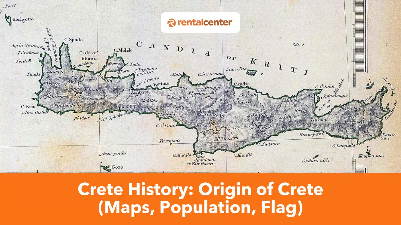
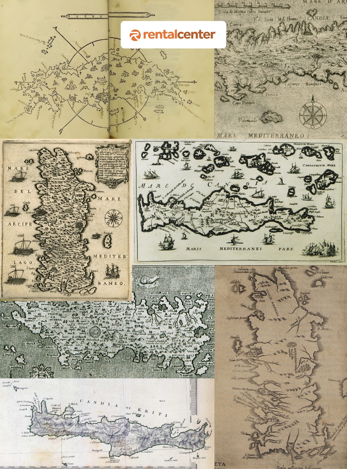
What are the historical maps of Crete?
Historical maps of Crete depict its cultural and strategic importance over centuries. The Venetian map of the Siege of Candia (1669), attributed to Francesco Basilicata, showcases Candia’s fortifications, fleets, and Ottoman camps during the Cretan War (1645–1669). It served to rally European support for Venice as a Christian stronghold in the Eastern Mediterranean. Abraham Ortelius’ Candia Insula (1598), included in Theatrum Orbis Terrarum, detailed Crete’s geography and significance under Venetian rule. Key archaeological sites are prominently featured in historical maps. Knossos represents the Minoan civilization, Phaistos contains the Phaistos Disk, and Gortyn is noted for its Roman law code. Venetian maps emphasized fortresses like Spinalonga and Candia, while Ottoman maps prioritized military positions.
Find below an image showing various historical maps of Crete.
Who explored Crete?
Sir Arthur Evans, a British archaeologist, explored Crete and uncovered its archaeological significance. 1900 Evans began excavating Knossos, revealing the Minoan civilization, a Bronze Age culture that thrived from 2600 to 1100 BCE. His discoveries included multistoried palaces, advanced drainage systems, frescoes, and artifacts. Evans identified undeciphered scripts like Linear A and connected Minoan culture to Greek mythology, such as the Labyrinth and Minotaur. Evans first visited Crete in 1894, inspired by carved seal stones and ancient scripts. He purchased the Knossos site in 1899 and led excavations until 1931.
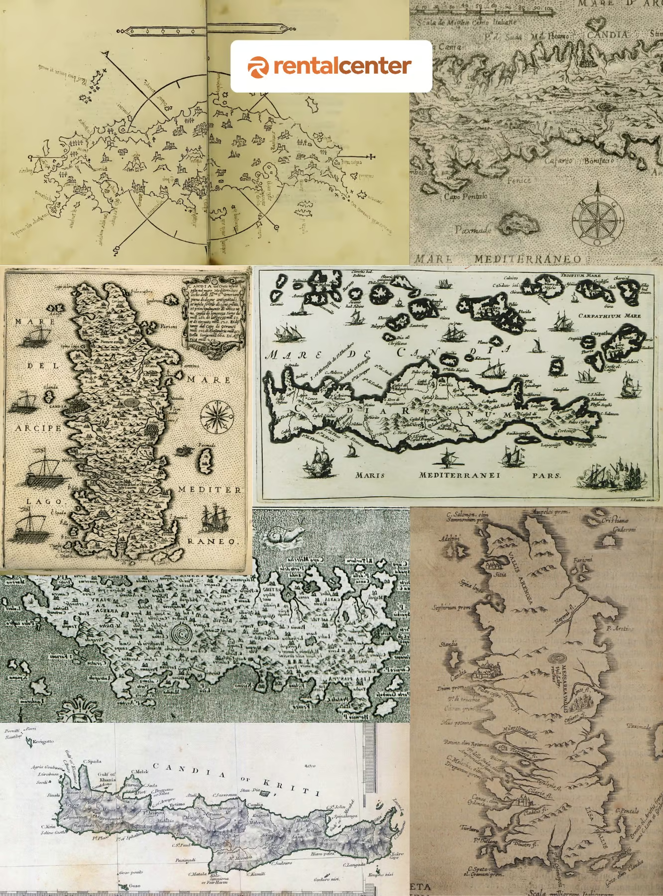
What is the Crete flag?
The flag of the autonomous Cretan State (1898–1913) represented Crete’s transitional status under Ottoman suzerainty. It displayed a white cross on a blue background, symbolizing Greek identity and Orthodox Christianity, with a red canton and white star in the upper left corner, signifying Ottoman sovereignty. This design reflected Crete’s aspirations for union with Greece while acknowledging its political reality as an autonomous state.
The flag was introduced in 1898, following the intervention of the Great Powers (UK, France, Italy, Russia) to end Ottoman rule. Prince George of Greece served as High Commissioner during this period. 1908, the red canton was removed when Crete declared union with Greece, and it was finalized in 1913 after the Balkan Wars.
Find below an image describing the Crete Flag.

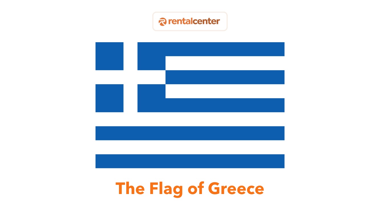
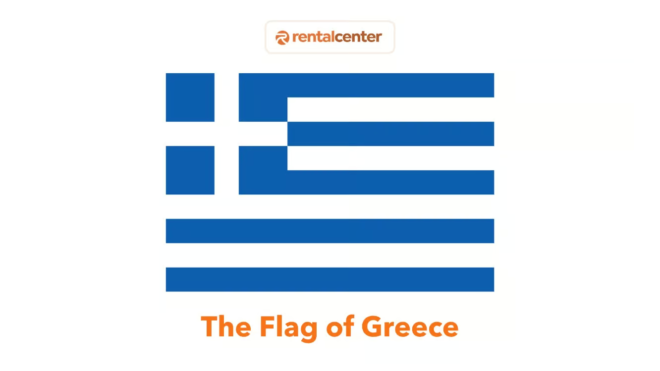
Today, Crete uses the Greek national flag, but the historical flag symbolizes its struggle for independence and cultural identity.
Find below an image describing the Greece National Flag.
What is the population of Crete?
Crete’s population is 624,408, making it Greece’s largest and most populous island. It accounts for 5.76% of Greece’s total population, with a density of 74.9 people per square kilometer. Crete has experienced population growth historically, with a 19.71% increase between 1981 and 2001 and 3.36% between 2001 and 2011. Most inhabitants live in urban areas like Heraklion, Chania, Rethymno, and Agios Nikolaos, while rural regions face depopulation. Urban centers, especially on the northern coast, attract populations due to gentler terrain, better infrastructure, and job opportunities. Rural areas rely on agriculture, supported by fertile plains like the Lasithi Plateau and Messara Valley.
Over 95% of the population is Greek Orthodox, with religious festivals, such as Easter, playing a central role. Family and multigenerational households maintain traditional practices, while urbanization has introduced modern influences. Crete faces demographic challenges, including aging populations, low fertility rates, and rural depopulation. Natural population decline, with deaths exceeding births, is evident, particularly in rural areas. Urban centers like Heraklion and Chania may retain younger populations, but the decrease in the population aligns with broader trends in Greece.
What is the drinking age in Crete?
The legal drinking age in Crete, as in all of Greece, is 18 years for purchasing and consuming alcohol in public. Enforcement can be inconsistent, particularly in tourist areas, but carrying identification is recommended. Driving laws regarding alcohol are strict. The legal blood alcohol concentration (BAC) limit is 0.05% for most drivers and 0.02% for motorcyclists or drivers with less than two years of experience. Penalties for violations include fines of €200 ($211, £172.) to €3,000 ($3,174, £2,594), license suspension, and potential jail time for severe or repeat offenses.
What are the historical eras of Crete?
Crete has a long and complex timeline marked by distinct periods. Significant cultural, political, and social developments define each era’s influence:
- Prehistoric and Neolithic Era: Human settlement on Crete began around 7000 BCE, with Neolithic farmers from Anatolia establishing early communities like Knossos and Trapeza. These settlers introduced agriculture, domesticated animals, and essential tools, forming Europe’s earliest agricultural societies.
- Minoan Civilization: Crete became home to Europe’s first advanced civilization, the Minoans, known for palatial centers like Knossos, Phaistos, and Zakros. They developed maritime trade, art, and writing systems such as Linear A. Decline following the Thera eruption (around 1450 BCE) and subsequent Mycenaean invasions.
- Mycenaean and Dark Age: After the Minoans, Crete fell under Mycenaean control. The following “Dark Age” yielded limited records but revealed Dorian migration and a cultural transition.
- Archaic and Classical Periods: Crete splintered into city-states like Gortyn and Knossos, creating a complex political landscape. The Law Code of Gortyn was inscribed during this time. Internal strife and piracy reduced the island’s regional stature.
- Hellenistic and Roman Periods: Rome annexed Crete in 67 BCE after staunch resistance, merging it into the Roman province of Creta et Cyrenaica with Gortyn as its capital. Roman rule introduced infrastructure and early Christian communities.
- Byzantine Period: Crete became a Christian hub under Byzantine authority but faced frequent pirate incursions. Andalusian Arabs briefly took control in 824 CE, founding Heraklion (Handak), before Byzantine forces reclaimed Crete in 961 CE.
- Arab Rule: Arab control turned Heraklion into a fortified city and a central node of piracy, challenging Byzantine dominance until reconquest in 961 CE.
- Venetian Rule: Venice took Crete after the Fourth Crusade in 1204 and named it the “Kingdom of Candia.” The island grew into a cultural center influenced by Renaissance art and literature, but heavy taxation led to ongoing revolts.
- Ottoman Rule: After a drawn-out siege of Candia, Crete fell to the Ottomans in 1669. Frequent rebellions by Christian Cretans sought autonomy or union with Greece.
- Cretan State and Union with Greece: International intervention ensured Crete’s autonomy in 1898, with Prince George of Greece as High Commissioner. Crete officially united with Greece in December 1913, concluding long-standing foreign control.
What are Cretan Cultures?
Cretan culture embodies traditions and practices shaped by its long history and Mediterranean identity. Its defining elements include:
- Traditional Dances: Cretan dances such as Pentozali, Syrtos, and Sousta represent the island’s identity. The Pentozali symbolizes revolution, and the Sousta reflects romantic interaction. These dances use instruments like the lyra and laouto and are frequently performed during festivals and community gatherings.
- Cretan Music: Music is a central cultural element, featuring the Lyra and laouto. Traditional songs, including mantinades, convey intense emotions during social occasions.
- Traditional Costumes: Men’s attire, such as vraka and sariki, and women’s embroidered garments show regional style variations and symbolisms of joy, mourning, or belonging.
- Handicrafts: Crete’s craftsmanship includes pottery inspired by Minoan patterns, basket weaving, engraved knives, and woven textiles. Specific locales like Margarites and Thrapsano excel in pottery, while Chania is noted for knife-making.
- Cretan Cuisine: Emphasizing fresh ingredients such as olive oil, honey, herbs, and cheese, Cretan dishes like dakos, kalitsounia, and antikristo lamb illustrate a culinary tradition rooted in agrarian abundance. Raki often accompanies meals.
- Festivals and Feasts: Local celebrations honor seasonal produce, religious events, and cultural heritage. They include the Houdetsi Festival and the Thrapsano Pottery Festival, as well as religious observances like the Assumption of Mary at Panagia Charakiani.
- Religious Customs: Greek Orthodoxy, pilgrimages, symbolic bread (lazaropsoma), and protective practices involving sea squills manifest spiritual dimensions of everyday life.
Which language is spoken in Crete?
The primary language spoken in Crete is Greek, specifically Modern Greek, which serves as the official language of Greece. The Cretan dialect (Kritiki Dialektos) is widely spoken on the island. This dialect features unique vocabulary, pronunciation, and expressions that set it apart from standard Greek language. For example, words like inta (what) and edá (now) are distinctive to the dialect. The Cretan dialect evolved from Koine Greek, the common language of the Hellenistic and Byzantine periods, and incorporates influences from Venetian, Turkish, and Arabic. English is commonly spoken, particularly in urban centers like Heraklion, Chania, and Rethymno. Other foreign languages, including German, French, and Italian, are spoken to a lesser extent.
What are the neighboring islands to Crete?
Crete’s position at a crossroads of the Mediterranean places it near numerous smaller islands with distinct natural, cultural, and historical attributes. Several have served as strategic waypoints for maritime trade, while others host ecological preserves or archaeological traces linking them to ancient civilizations. These neighboring islands to Crete include:
- Gavdos: Gavdos is located 50 kilometers (31 miles) south of Crete. It is Europe’s southernmost inhabited island. It is known for unspoiled beaches like Sarakiniko and Tripiti, the latter being the southernmost point of Europe. It is accessible by ferries from Paleochora and Sfakia.
- Chrissi: Chrissi Island is located South of Ierapetra and is known for its turquoise waters, pink-sand beaches formed by crushed shells, and juniper trees. The uninhabited island is accessible by boat trips from Ierapetra and offers beaches like Golden Beach.
- Dia: Dia is an uninhabited island of ecological and historical importance, protected under Natura 2000. It features hiking trails, snorkeling spots, and Minoan-era archaeological significance. The island’s shape resembles a dragon, tying it to Greek mythology.
- Paximadia Isles: The Paximadia Isles are two uninhabited islets near Agia Galini and Matala. They are linked to the myth of Leto, who gave birth to Apollo and Artemis there. The islets offer secluded beaches ideal for snorkeling and fishing.
- Koufonisi: Koufonisi is located southeast of Crete near Makrigialos. It is known as the “Delos of Crete,” which features Minoan archaeological sites and sandy beaches with turquoise waters. The landscape resembles North Africa and can be visited via boat trips from Makrigialos.
- Spinalonga: Spinalonga is located in the Gulf of Elounda. It is famous for its Venetian fortress and history as a leper colony until 1957. It attracts visitors for historical tours that showcase its Venetian and Ottoman influences.
- Gramvousa: Gramvousa is near the Balos Lagoon in northwestern Crete and features a Venetian fortress offering views and a shipwreck near its beach. It is a popular destination for day trips.
- Thodorou: Thodorou is uninhabited but serves as a conservation area for the endangered Cretan wild goat (kri-kri). It plays a critical ecological role in local wildlife preservation.
Last updated on .