
One of the most enduring emblems of that identity is the Crete flag, the historical flag of the autonomous Cretan State, whose colours and symbols are explained in full below. Its strategic geographical position, historical layers, and archaeological heritage continue to shape its cultural and economic significance.
Disclaimer: This article provides a general historical overview of Crete intended for travellers and history enthusiasts. Dates and historical interpretations draw on the academic sources listed in the bibliography. Archaeological knowledge of the Minoan period continues to evolve, readers seeking the most current scholarship are encouraged to consult the Heraklion Archaeological Museum and peer-reviewed sources.
Crete History Timeline (Quick Reference)
| Period | Dates | Key Events |
|---|---|---|
| Neolithic | 7000–3000 BCE | First settlements at Knossos; earliest Aegean pottery |
| Early Minoan (Prepalatial) | 3000–1900 BCE | Bronze Age culture emerges; tholos tombs |
| Protopalatial | 1900–1700 BCE | First palaces built; Linear A script; trade with Egypt |
| Neopalatial | 1700–1450 BCE | Peak Minoan civilization; Knossos, Phaistos, Malia, Zakros |
| Mycenaean Crete | 1450–1200 BCE | Mycenaean takeover; Linear B script at Knossos |
| Greek Dark Ages | 1200–800 BCE | Collapse and reorganization into city-states |
| Archaic / Classical | 800–67 BCE | The “hundred poleis”; Gortyn Law Code (c. 450 BCE) |
| Roman Crete | 67 BCE–330 CE | Province of Creta et Cyrene; capital at Gortyn |
| Byzantine I | 330–824 CE | Christian basilicas; administrative integration |
| Arab occupation | 824–961 CE | Founding of Handak (Heraklion) |
| Byzantine II | 961–1204 CE | Reconquest by general Nikephoros Phokas (961 CE) |
| Venetian rule | 1205–1669 | Kingdom of Candia; Cretan Renaissance |
| Ottoman rule | 1669–1898 | Cretan revolts; Arkadi (1866); autonomous Cretan State (1898) |
| Modern Crete | 1913–present | Union with Greece (1913); Battle of Crete (1941) |
What is Crete’s History?
Crete’s recorded history spans over 9,000 years, from the first Neolithic settlers of 7000 BCE through Minoan, Mycenaean, Roman, Byzantine, Arab, Venetian, and Ottoman rule, ending with unification with Greece in 1913.
Crete’s history begins in the 7th millennium BCE, making it one of Europe’s oldest inhabited regions. Between 2700 and 1450 BCE, it became the center of the Minoan civilization, Europe’s first advanced society, recognized for monumental palaces such as Knossos and maritime power. The Minoan decline followed the Thera eruption (1450 BCE) and Mycenaean invasions. In the Classical period, Crete was divided into city-states, later becoming a Roman province in 67 BCE with Gortyn as its capital.
In 330 CE, Crete joined the Byzantine Empire but was conquered by Andalusian Arabs in 824 CE, who established the Emirate of Crete. Byzantine forces recaptured it in 961 CE. After the Fourth Crusade (1204), Venice claimed Crete in 1205 (with control consolidated by 1212), ruling it as the “Kingdom of Candia” for over four centuries despite frequent uprisings. The Ottomans seized Crete in 1669 after a prolonged siege, ruling until 1898, despite resistance from Cretans aiming for union with Greece.
In 1898, Crete became the autonomous Cretan State under Ottoman suzerainty, officially uniting with Greece in December 1913 after the Balkan Wars. During World War II, Crete was a key battleground during the German invasion of 1941.
Where did Crete originate?
Crete was first settled around 7000 BCE by Neolithic farmers from Anatolia, making it one of the earliest agricultural communities in Europe.
Crete originated as an inhabited island during the early Neolithic period around 7000 BCE when farmers from Anatolia colonized it. These settlers formed one of Europe’s first Neolithic communities at Knossos and introduced agriculture with domesticated animals and crops. Over time, Crete developed into a cultural hub, culminating in the Minoan civilization around 3000 BCE, Europe’s first advanced society. The Minoans excelled in maritime trade, architecture, and art until their decline around 1450 BCE due to natural disasters and Mycenaean invasions. Archaeological evidence suggests earlier human activity, as archaic humans may have visited Crete as early as 130,000 years ago.
The Minoans: Europe’s First Civilization (c. 2700–1450 BCE)
The Minoan civilization (c. 2700–1450 BCE) was the first advanced society in Europe, building multi-story palaces with drainage and plumbing systems, creating the first European writing system (Linear A), and establishing trade routes from Egypt to Spain, centuries before the rise of classical Athens. The civilization emerged from earlier Neolithic cultures around 3000 BCE, reached its palatial peak between 1900 and 1450 BCE, and collapsed c. 1450 BCE following the Thera eruption and Mycenaean incursions.
The civilization takes its name from the legendary King Minos, applied retroactively by Sir Arthur Evans, who excavated Knossos beginning in 1900 CE.
Minoan Palaces: Knossos, Phaistos, Malia, and Zakros
The Minoans built four major palace complexes that served simultaneously as religious, administrative, cultural, and commercial centres:
- Knossos, the largest palace, 5 kilometers (3.11 miles) south of modern Heraklion. The site covers ~20,000 m² and contains over 1,500 rooms across multiple stories, with frescoes, drainage, and the throne room. Excavated by Sir Arthur Evans from 1900 CE.
- Phaistos, second-largest palace, on the Messara plain. Famous for the Phaistos Disk (c. 1700 BCE), a clay disc stamped with 241 undeciphered symbols.
- Malia, third-largest palace, on the north coast east of Heraklion. Notable for its central court, granaries, and the Malia Pendant (gold bee jewellery).
- Zakros, easternmost palace, on the coast of the Sitia peninsula. The smallest of the four major palaces and the only one not looted in antiquity.
Construction used ceramic bricks and rough stones bonded with mortar, with sharply defined large rectangular blocks at the corners. No Minoan palace excavated to date is surrounded by defensive walls, a sign of the civilization’s relative security and naval dominance during its peak.
Minoan Trade, Art, and Writing (Linear A)
Minoan society was wealthy and trade-driven. The Minoans exported olive oil, wine, figs, and finished goods (pottery, jewellery, fresco-style art) in exchange for copper from Cyprus, ivory and gold from Egypt and the Levant, and tin from further east. Trade networks reached across the eastern Mediterranean and as far as the Iberian peninsula.
Linear A, the Minoan writing system, used c. 1850–1450 BCE, remains undeciphered. It was inscribed on clay tablets, libation tables, and vessels found at Knossos, Phaistos, and other palace sites. After the Mycenaean takeover, Linear A was adapted into Linear B, a writing system used to record an early form of Greek, finally deciphered by Michael Ventris in 1952.
Minoan art is characterised by colourful frescoes (the Bull-Leaper, the Prince of the Lilies, Saffron Gatherers), elegant rhytons (the Bull’s Head Rhyton from Knossos), the gold Snake Goddess figurine, the Hagia Triada Sarcophagus, and pottery in the Kamares and Marine styles.
Minoan “Firsts”, Documented European Innovations
The Minoans achieved several documented European firsts:
- The continent’s first paved road network, linking palaces and ports.
- Multi-story buildings with running water and flush toilets at Knossos (c. 1700 BCE).
- The first European writing system, Linear A (c. 1850–1450 BCE).
- Industrial-scale olive oil production (c. 2700 BCE).
- Wall-painting (fresco) as an architectural art form.
- A culture in which wealth was widely distributed (no fortified palaces, no centralised royal hoards comparable to contemporary Egypt or Mesopotamia).
Minoan Religion and Bull-Leaping
Minoan religion appears to have been organised around peak sanctuaries (open-air shrines on mountain summits) and cave sanctuaries (such as the Dikteon and Idaean caves), with female deities prominent in iconography. The famous bull-leaping fresco from Knossos depicts ritual acrobats vaulting over a charging bull, likely a religious ceremony rather than entertainment, central to Minoan symbolic life.
The Collapse: Thera Eruption and Mycenaean Takeover (c. 1450 BCE)
Around 1450 BCE, a combination of the Thera (Santorini) volcanic eruption, one of the largest in human history, and Mycenaean Greek incursions from the mainland brought the Minoan palatial system to an end. Mycenaeans took control of Knossos and adapted Minoan script into their own Linear B writing system. Knossos was finally destroyed c. 1380 BCE and never rebuilt.
Greek Mythology and the Legend of King Minos
Crete is the setting of some of the most enduring myths in Greek tradition, including the story of King Minos, the Minotaur imprisoned in the Labyrinth at Knossos, and the heroic voyage of Theseus. The island is also the mythological birthplace of Zeus, king of the Olympian gods.


The Minotaur, the Labyrinth, and Theseus
According to legend, King Minos of Crete commissioned the architect Daedalus to build the Minoan Labyrinth at Knossos to hold the Minotaur, a creature with the body of a man and the head of a bull, born to Minos’s wife Pasiphaë. Athens was forced to send seven youths and seven maidens every nine years as tribute, until Theseus of Athens slew the Minotaur with the help of Ariadne, Minos’s daughter, who gave him a ball of thread to navigate the maze.
The cast of Cretan myth includes Pasiphaë (mother of the Minotaur), Ariadne (who escaped Crete with Theseus), Phaedra (later wife of Theseus), Glaucus, Androgeus, Deucalion, Catreus, and Idomeneus, who led 80 Cretan ships to the Trojan War.
Zeus and the Sacred Caves of Crete
According to Greek mythology, Crete sheltered the infant Zeus in the Dikteon Cave (Lassithi plateau), where his mother Rhea hid him from his father Kronos, who had been swallowing his children to prevent prophesied overthrow. Zeus was raised by nymphs and nourished by the milk of the goat Amalthea, whose horn became the cornucopia and whose skin became Zeus’s aegis. Some traditions place his upbringing in the Idaean Cave on Mount Ida instead. Either way, Crete is the sacred birthplace of the king of the Olympian gods.
Talos the Bronze Guardian
Talos, a giant bronze automaton built by the smith-god Hephaestus, patrolled the shores of Crete three times a day, hurling boulders at invading ships. Often called the first robot in mythology, Talos was finally defeated by Medea, who removed the nail in his ankle that stopped his single vein of ichor from draining.
Iron Age and Classical Crete (1200–67 BCE)
After the Mycenaean period ended around 1200 BCE, Crete passed through the Greek Dark Ages (c. 1200–800 BCE) and reorganised into a network of independent city-states (poleis), ancient sources count as many as a hundred poleis on the island. The most influential were Gortyn, Knossos, Lyttos, Cydonia (modern Chania), Phaistos, and Lato, see our guide to the 14 Ancient Cities in Crete for the most important sites still visitable today. Dorian Greeks had migrated to the island during this period and shaped the dialect and political institutions.
The Hundred City-States and the Law Code of Gortyn
The most important surviving artefact of Classical Crete is the Gortyn Law Code (c. 450 BCE), one of the oldest surviving legal inscriptions in the Greek world, carved on twelve stone columns at the agora of Gortyn. Written in the local Dorian dialect, the code regulates marriage, inheritance, property, slavery, and adoption, and is a primary source for understanding Greek legal thought before Athenian classical law.
Cretan Mercenaries and the Roman Conquest
Cretan archers were renowned across the ancient Mediterranean and served as mercenaries in the armies of Alexander the Great, Carthage, and Rome. Rome eventually absorbed Crete during the Cretan–Roman War (69–67 BCE) under the proconsul Quintus Caecilius Metellus, who earned the cognomen Creticus. The Romans established Gortyn as the provincial capital of Creta et Cyrene (Crete and Libya combined), where the city would remain the island’s administrative centre for the next four centuries.
Byzantine, Arab, and Venetian Crete (330–1669 CE)
Between the fall of the Roman Empire and the Ottoman conquest, Crete changed hands three times, from Byzantine (330–824 CE) to Arab rule (824–961 CE), back to Byzantine (961–1204 CE), then to Venetian control in 1205, initiating 460 years of Western European influence.
Arab Occupation and Byzantine Reconquest
In 824 CE, Andalusian Arabs led by Abu Hafs Umar conquered Crete and made it the base of an emirate that dominated the eastern Mediterranean as a hub for piracy and slave-trading. The Arabs founded Rabd al-Khandaq (“the moat”), the city we now call Heraklion (medieval Greek Chandax, Italian Candia). Byzantine general, later emperor, Nikephoros Phokas reconquered the island after a brutal nine-month siege of Chandax in 961 CE, restoring Crete to the Byzantine Empire for another 240 years.
Venetian Rule and the Kingdom of Candia (1205–1669)
Following the Fourth Crusade and the sack of Constantinople in 1204, Venice claimed Crete in 1205 and held it for 460 years as the Kingdom of Candia, Venice’s most important overseas possession. The Venetians built the massive fortifications still visible in Heraklion (Koules Castle, the city walls), Rethymno (Fortezza), Chania (Old Venetian Harbour and arsenals), and on the islet of Spinalonga (built 1579) in the Gulf of Elounda.
The Cretan Renaissance and El Greco
Venetian rule produced the Cretan Renaissance, a cultural flowering that fused Byzantine iconography with Italian Renaissance technique. The most famous product of this period is Domenikos Theotokopoulos, known to art history as El Greco, born in Heraklion (then Candia) in 1541, who trained in the Cretan icon-painting tradition before emigrating first to Venice and later to Toledo, Spain. The Cretan School of icon painting also produced Michael Damaskinos and Theophanes Strelitzas, and Cretan literature reached a peak with Vitsentzos Kornaros‘s epic romance Erotokritos (c. 1600).
Ottoman Crete and the Struggle for Independence (1669–1913)
Ottoman rule over Crete from 1669 to 1898 was marked by repeated uprisings, culminating in the 1866 Arkadi Monastery siege, a defining moment of Cretan resistance, and ultimately the creation of the autonomous Cretan State in 1898. The Ottomans took the island after the 21-year siege of Candia (1648–1669), the longest siege in history at that time.
Cretan Revolts and the Arkadi Monastery (1866)
Ottoman rule provoked repeated rebellions in 1770, 1821 (during the Greek War of Independence), 1841, 1858, and most famously in 1866, when several hundred Cretan civilians and fighters took refuge in the Moni Arkadiou (Arkadi Monastery) southeast of Rethymno. Surrounded by Ottoman forces, the abbot ordered the gunpowder magazine ignited rather than surrender, killing defenders and besiegers alike. The event galvanised European public opinion and remains a foundational moment in modern Cretan identity. The Halepa Pact (1878) later granted Crete partial autonomy within the Ottoman Empire.
The Cretan State and Eleftherios Venizelos
Following further uprisings, Crete became an autonomous state under Ottoman suzerainty in 1898, governed by Prince George of Greece as High Commissioner. The most influential political figure of this period, and arguably the most important Cretan in modern Greek history, was Eleftherios Venizelos (1864–1936), born near Chania, who led the Therisos uprising of 1905 and went on to become Prime Minister of Greece seven times. The autonomous Cretan State also adopted its own flag in 1898, described in full in the Crete flag section below.
Union with Greece (1913)
After the Balkan Wars, Crete formally united with the Greek state on 1 December 1913, ending 700 years of foreign rule. The union was formalised by the Treaty of London. Eleftherios Venizelos signed the union documents at Chania.
Crete in World War II: The Battle of Crete (1941)
In May 1941, Nazi Germany launched Operation Mercury, the first major airborne invasion in military history, to conquer Crete. After ten days of fierce fighting (20–31 May 1941) against Allied forces (British, New Zealand, Australian, and Greek troops) and armed Cretan civilians, the island fell to German forces. The Cretan civilian resistance, which included the famous kidnapping of General Heinrich Kreipe in 1944 by SOE officers and Cretan partisans, continued throughout the occupation. The civilian defence was so fierce that Adolf Hitler banned further large-scale airborne operations for the remainder of the war. Crete was liberated in October 1944.
Where is Crete on a map?
Crete is located in the southern Aegean Sea, 16 kilometers (99.42 miles) south of mainland Greece, at coordinates 35.24°N, 24.81°E, the fifth-largest island in the Mediterranean.
Crete lies in the southern Aegean Sea, 16 kilometers (99.42 miles) south of mainland Greece. Greece’s largest island and the Mediterranean’s fifth-largest, after Sicily, Sardinia, Cyprus, and Corsica. The island covers 8,450 square kilometers (3,260 square miles), stretching 26 kilometers (161.56 miles) from west to east and up to 6 kilometers (37.28 miles) in width. It is positioned at the crossroads of Europe, Asia, and Africa. The Sea of Crete borders Crete to the north and the Libyan Sea to the south.
Crete’s geographical coordinates are 35.2401° N and 24.8093° E. Its capital and largest city, Heraklion, is located on the northern coast. The island features mountainous terrain, including the White Mountains (Lefka Ori) and Mount Ida (Psiloritis), the highest peak at 2,456 meters (8,058 feet).
Find below an interactive map of Crete showing its location in the Mediterranean.
What are the historical maps of Crete?
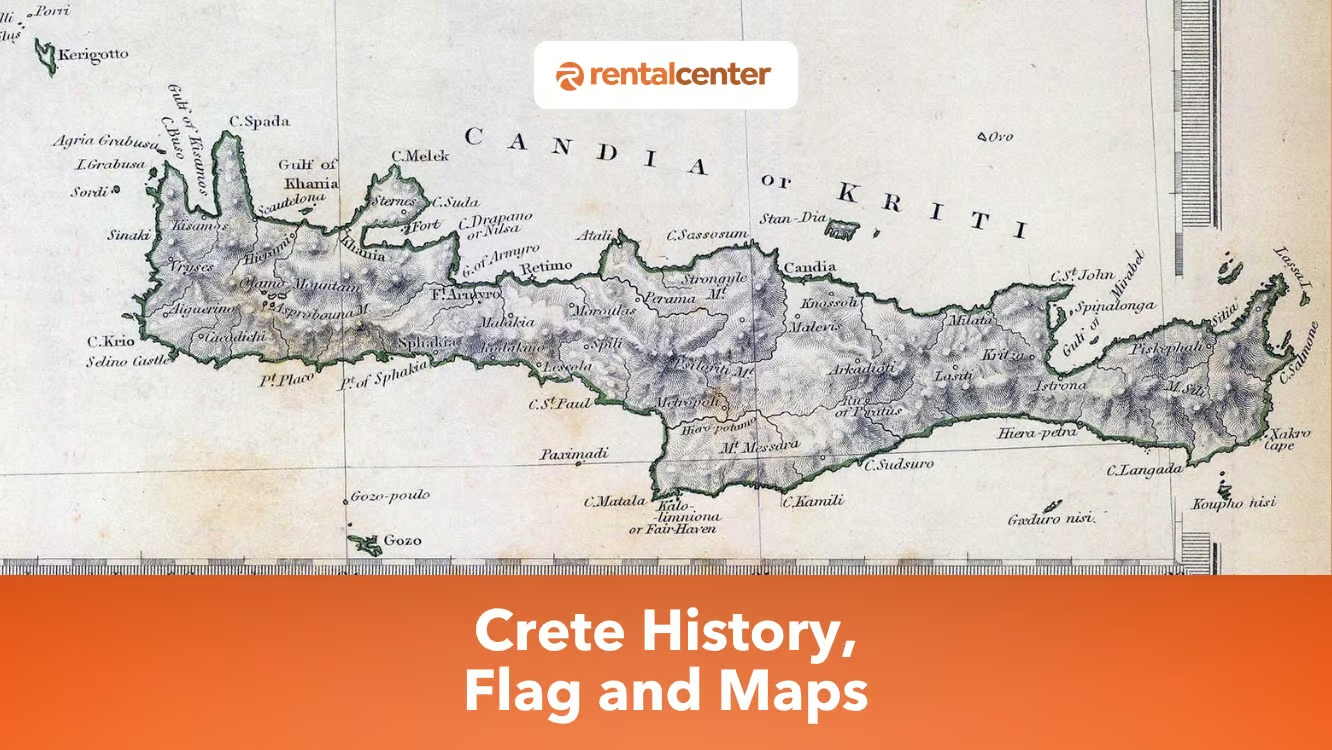
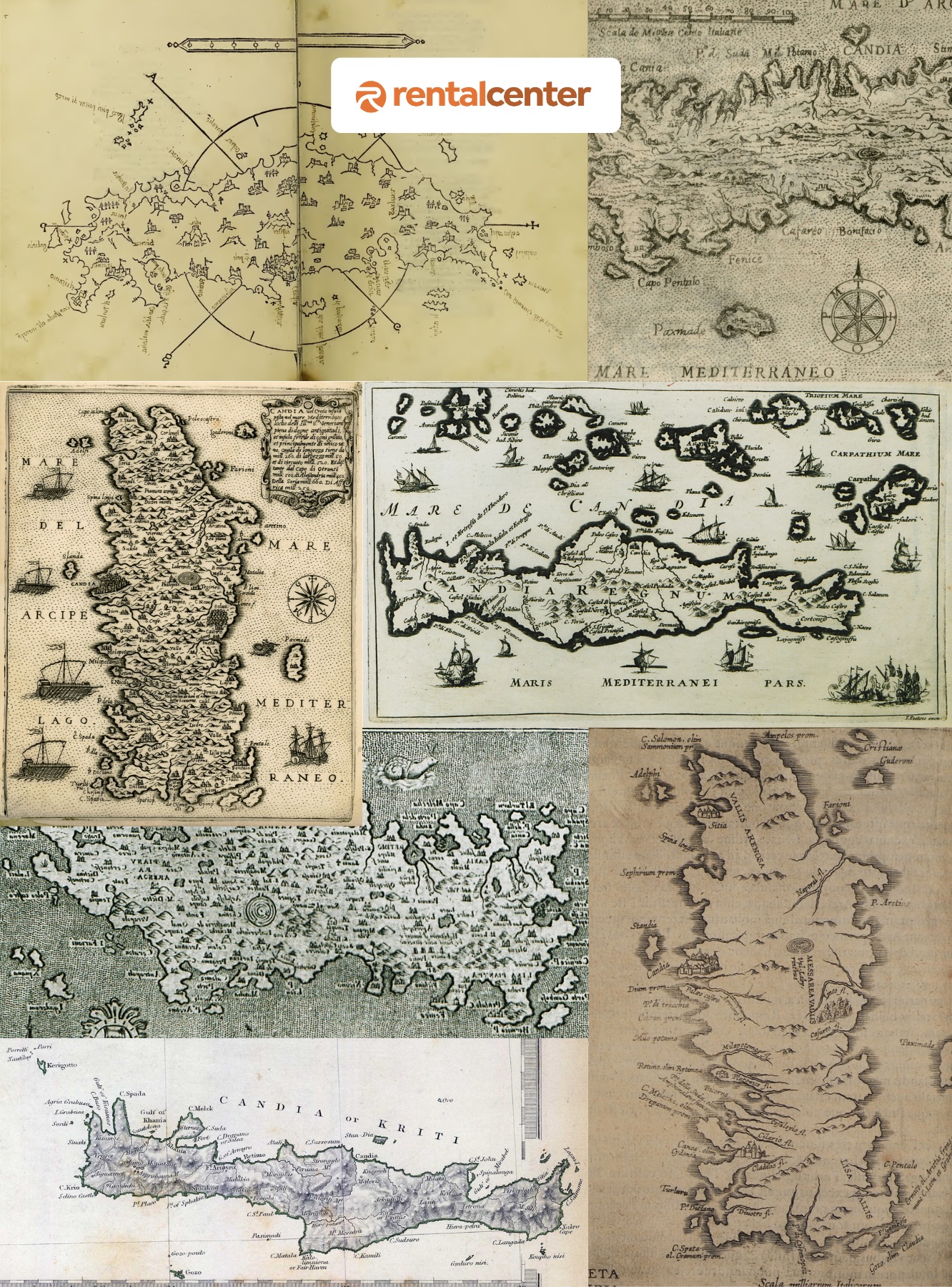
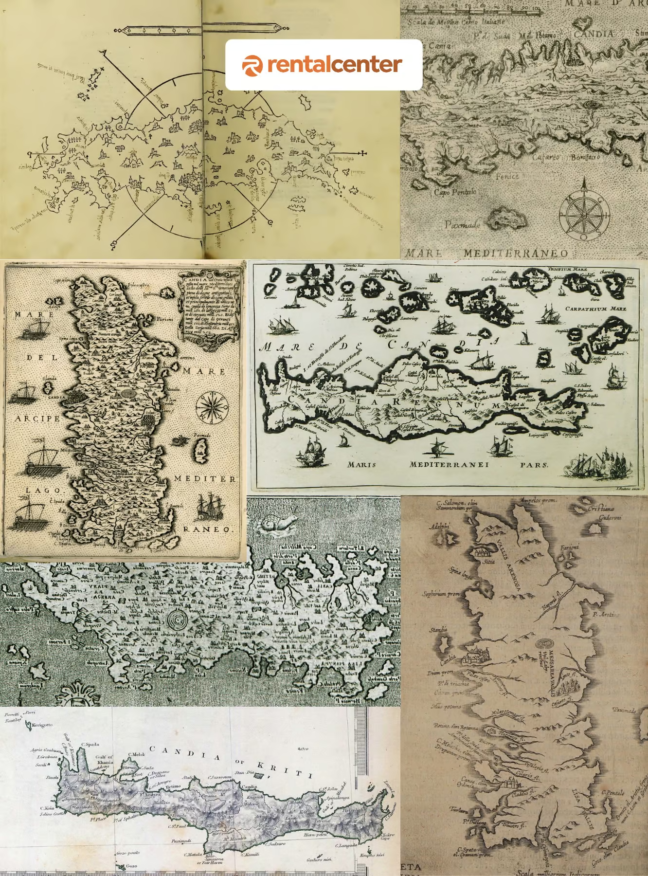
Historical maps of Crete depict its cultural and strategic importance over centuries. The Venetian map of the Siege of Candia (1669), attributed to Francesco Basilicata, showcases Candia’s fortifications, fleets, and Ottoman camps during the Cretan War (1645–1669). It served to rally European support for Venice as a Christian stronghold in the Eastern Mediterranean. Abraham Ortelius’ Candia Insula (1598), included in Theatrum Orbis Terrarum, detailed Crete’s geography and significance under Venetian rule. Key archaeological sites are prominently featured in historical maps. Knossos represents the Minoan civilization, Phaistos contains the Phaistos Disk, and Gortyn is noted for its Roman law code. Venetian maps emphasized fortresses like Spinalonga and Candia, while Ottoman maps prioritized military positions.
Who explored Crete?
Sir Arthur Evans, a British archaeologist, explored Crete and uncovered its archaeological significance. In 1900 Evans began excavating Knossos, revealing the Minoan civilization, a Bronze Age culture that thrived from 2600 to 1100 BCE. His discoveries included multistoried palaces, advanced drainage systems, frescoes, and artifacts. Evans identified undeciphered scripts like Linear A and connected Minoan culture to Greek mythology, such as the Labyrinth and Minotaur. Evans first visited Crete in 1894, inspired by carved seal stones and ancient scripts. He purchased the Knossos site in 1899 and led excavations until 1931.
Geography and Natural Features of Crete
Crete’s terrain is dominated by three mountain ranges, deep gorges, and a coastline of sandy and pebbled beaches, shaped by a geological history that predates the island’s separation from the mainland around 8 million years ago.
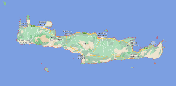

A central spine of mountains runs the length of the island, with Mount Ida (Psiloritis, 2,456 m) as its highest peak, followed by the White Mountains (Lefka Ori) in the west and the Dikti range in the east. Crete is famous for its gorges (Samaria, Imbros, Aradena), sandy and pebbled beaches, six small rivers, and the freshwater Lake Kournas in Chania. Climate ranges from temperate to subtropical, with hot dry summers and mild winters; annual precipitation averages 640 mm. For a deeper look at the island’s terrain and regional divisions, see our overview of Crete’s geography.
How Crete Was Formed (Geological Origin)
More than 500 million years ago, the area now occupied by Crete was submerged in the Tethys Sea. Around 200 million years ago, Pangaea broke apart. Between 70 and 55 million years ago, the African and Eurasian plates collided, forcing the Tethys floor upward and creating a chain of mountains from the Atlas to the Himalayas, the Dinaric–Tauric arc that runs through the Balkans into Asia Minor. Crete was uplifted in the middle of this arc. The island finally separated from the surrounding landmass approximately 8 million years ago.
What is the Crete flag?
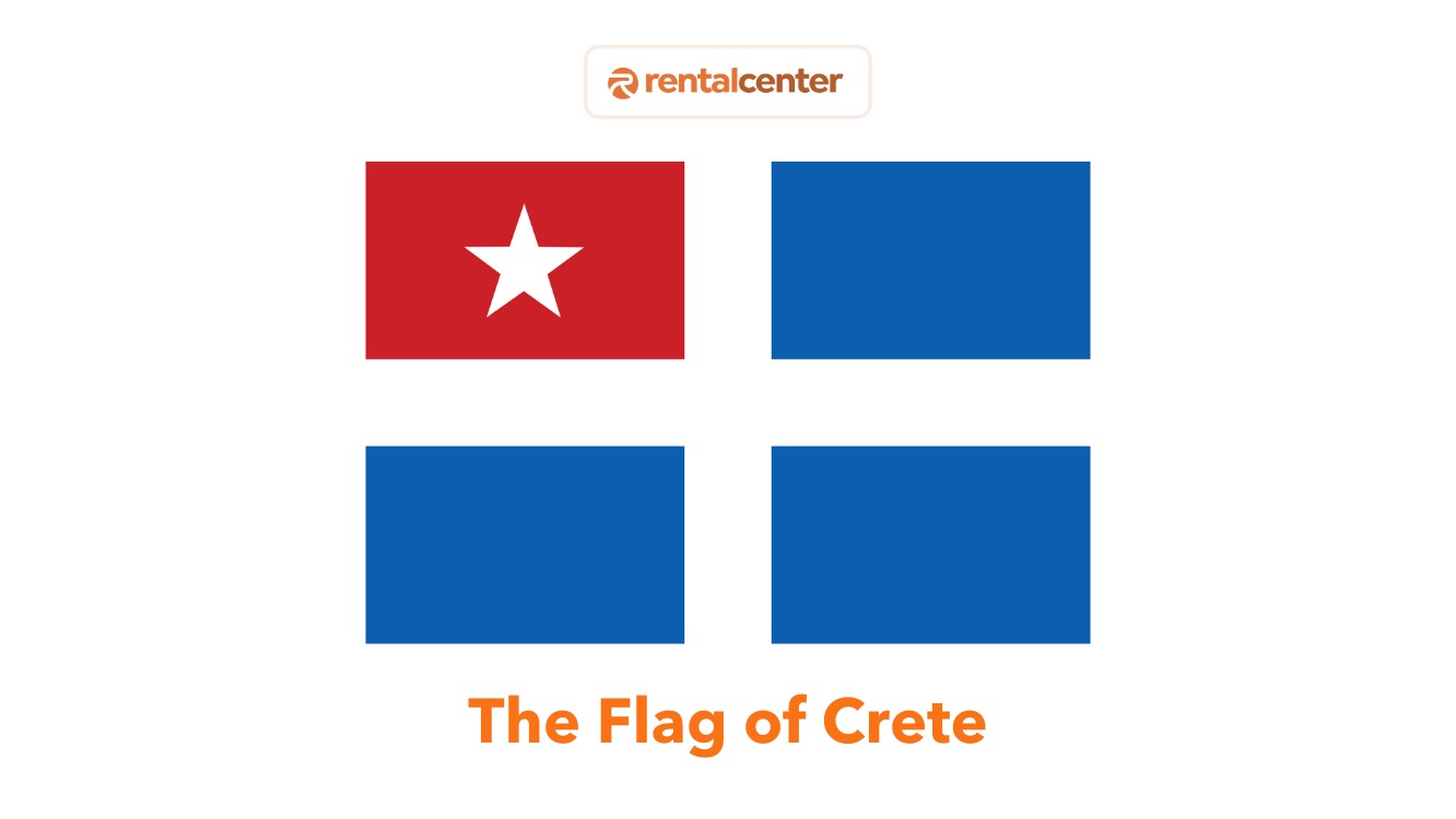
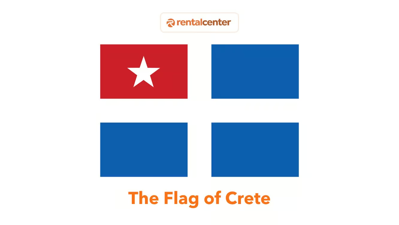
The Crete flag is the historical flag of the autonomous Cretan State (1898–1913): a blue field with a white cross and a red canton containing a white star in the upper-left corner, a design mandated by the Great Powers to balance Cretan and Ottoman political claims.
The Cretan State flag (1898–1913) embodied Crete’s transitional political status: nominally Ottoman, culturally Greek, and administered under international supervision. This was a genuine autonomous state flag, born of Cretan autonomy rather than full independence, and it reflected Crete’s aspirations for union with Greece while acknowledging its political reality as an autonomous state under Ottoman suzerainty.
The four Great Powers, Britain, France, Italy, and Russia, introduced the Cretan State flag in December 1898 after intervening to end Ottoman rule on the island. Prince George of Greece served as High Commissioner during this period.
Find below an image describing the Crete Flag.
Sources for flag design and symbolism: Wikipedia, “Cretan State” (citing McTiernan 2014 and Macrakis 2006); Flags of the World (CRW Flags, crwflags.com/fotw/flags/gr-cr.html); Chania Naval Museum (displays original Cretan State flags and conducts a weekly flag-raising ceremony).
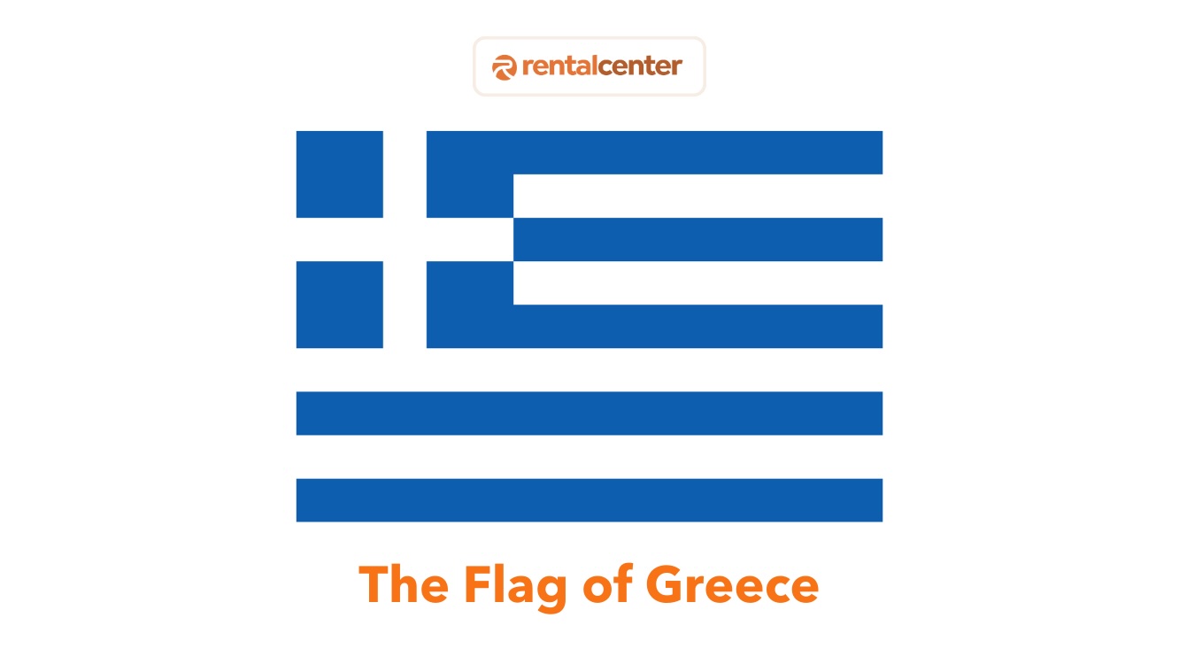
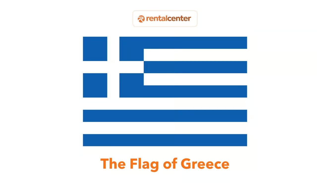
Find below an image describing the Greek Flag.
What do the colours and symbols on the Crete flag mean?
Each element of the Cretan State flag was chosen by the Great Powers to represent a specific political reality: the blue cross for Greek identity, the red canton for Ottoman sovereignty, and the white star for Ottoman suzerainty.
The Cretan State flag consists of four design elements, each carrying a specific political meaning. This flag symbolism combines the blue cross flag of Greek identity with heraldic markers of Ottoman authority:
| Element | Colour | Symbolism |
|---|---|---|
| Background field | Blue | Alignment with Greece (Greek national colour since the War of Independence) |
| Cross | White | Greek Orthodox Christianity and Hellenic identity |
| Canton (upper-left quarter) | Red | Ottoman imperial sovereignty, marking Crete as still within the Ottoman Empire |
| Star (inside canton) | White | Ottoman suzerainty, the specific symbol chosen by the Great Powers to signal Crete’s nominal Ottoman status |
This design was not chosen by the Cretans themselves. The four Great Powers, the United Kingdom, France, Italy, and Russia, mandated the flag’s design when they established the Cretan State in December 1898, balancing Cretan aspirations for union with Greece against Ottoman territorial claims. The white star specifically represents Ottoman suzerainty, as documented in the Flags of the World registry (CRW Flags) and confirmed by the Chania Naval Museum’s display of the original flag.
How did the Crete flag change over time?
The Cretan State flag went through two versions: the original 1898 design with the red canton, and the 1908 version without it, after Crete unilaterally declared union with Greece.
How the Crete flag changed: 1898–1913
| Year | Flag version | Key change | Political context |
|---|---|---|---|
| 1898 | Original Cretan State flag | Blue field, white cross, red canton with white star | Autonomous Cretan State established under Prince George of Greece as High Commissioner |
| 1908 | Modified flag | Red canton and white star removed | Cretan Assembly unilaterally declared union with Greece on 7 October 1908 |
| 1913 | Flag retired | Replaced by Greek national flag | Treaty of London (30 May 1913) and formal union with Greece (1 December 1913) |
The Cretan Assembly removed the red canton in 1908 when it unilaterally declared union with Greece. The Treaty of London (May 1913) and formal union with Greece (December 1913) then retired the Cretan State flag permanently. In total, the Cretan State flag existed for exactly 15 years (1898–1913), serving as the symbol of Crete’s transitional period between Ottoman rule and Greek sovereignty.
Does Crete have its own flag today?
No, Crete does not have an official regional flag today; as a region of Greece, it flies the Greek national flag, while the historical Cretan State flag is used informally as a cultural symbol.
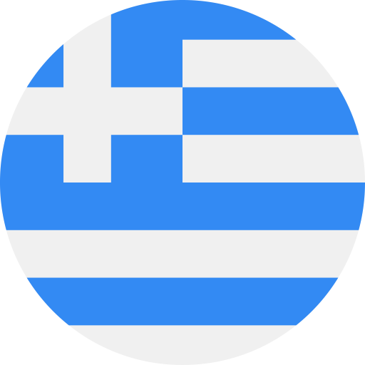
As a regional unit of Greece since December 1913, Crete flies the Greek national flag, blue and white horizontal stripes with a white cross on a blue canton in the upper left.
The historical Cretan State flag (blue field, white cross, red canton with white star), sometimes informally called the Cretan Republic flag, is not an official flag but continues to be used as an unofficial cultural symbol. It appears on locally-woven textiles, commemorative items, and is associated with the weekly flag-raising ceremony at the Chania Naval Museum, the fort where the 1913 union was formally completed. Today, Crete flies the Greek national flag; the historical Cretan State flag survives as an unofficial cultural symbol of the island’s century-long struggle for independence and cultural identity.
Find below an image describing the Greece National Flag.
Note: The Cretan State flag (1898–1913) is a historical flag, not an official regional flag of modern Crete. Crete is a region of Greece and uses the Greek national flag for all official purposes. The Cretan State flag may sometimes be seen in informal or cultural contexts, but it carries no official administrative status under Greek law.
What are the historical flags of Crete before 1898?
Before the Cretan State flag of 1898, Cretan revolutionaries fought under their own banners during the 19th-century uprisings against Ottoman rule.
- ΚΕΕΘ flag (1866 Arkadi revolt): a blue background with a Byzantine-cross-inspired design and the motto “Κρήτη, Ελλάς Ένωσις ή Θάνατος” (Crete, Greece: Union or Death).
- Revolutionary captain standards: the 1803 Gianni Statha fleet flag, blue with a narrow white cross.
These revolutionary flags are displayed at the Chania Naval Museum, which holds the original Cretan State flags and remains the most authoritative physical source for the island’s flag history.
What is the population of Crete?
Crete’s population is 624,408 (2021 census), making it Greece’s most populous island and the largest by area at 8,450 km².
Crete’s population is 624,408, making it Greece’s largest and most populous island. It accounts for 5.76% of Greece’s total population, with a density of 74.9 people per square kilometer. Crete has experienced population growth historically, with a 19.71% increase between 1981 and 2001 and 3.36% between 2001 and 2011. Most inhabitants live in urban areas like Heraklion, Chania, Rethymno, and Agios Nikolaos, while rural regions face depopulation. Urban centers, especially on the northern coast, attract populations due to gentler terrain, better infrastructure, and job opportunities. Rural areas rely on agriculture, supported by fertile plains like the Lasithi Plateau and Messara Valley.
Over 95% of the population is Greek Orthodox, with religious festivals, such as Easter, playing a central role. Family and multigenerational households maintain traditional practices, while urbanization has introduced modern influences. Crete faces demographic challenges, including aging populations, low fertility rates, and rural depopulation. Natural population decline, with deaths exceeding births, is evident, particularly in rural areas. Urban centers like Heraklion and Chania may retain younger populations, but the decrease in the population aligns with broader trends in Greece.
What is the drinking age in Crete?
The legal drinking age in Crete, as in all of Greece, is 18 years for purchasing and consuming alcohol in public. Enforcement can be inconsistent, particularly in tourist areas, but carrying identification is recommended. Driving laws regarding alcohol are strict. The legal blood alcohol concentration (BAC) limit is 0.05% for most drivers and 0.02% for motorcyclists or drivers with less than two years of experience. Penalties for violations include fines of €200 ($230.74, £170.80) to €3000 ($3461.10, £2562.00), license suspension, and potential jail time for severe or repeat offenses.
Cretan Culture: Language, Cuisine, and the Arts
Crete has maintained a distinct cultural identity shaped by 9,000 years of history, expressed through the Cretan dialect (spoken continuously for over 3,500 years), a globally recognised Mediterranean cuisine, a living tradition of dance and music, and a literary tradition that produced Nikos Kazantzakis, nine-time Nobel Prize nominee.
Which language is spoken in Crete?
The official language of Crete is Modern Greek; the Cretan dialect (Kritiki Dialektos) is widely spoken alongside it, incorporating vocabulary from Venetian, Turkish, and Arabic.
The primary language spoken in Crete is Greek, specifically Modern Greek. Cretan Greek evolved from Koine, the common Greek of the Hellenistic, Roman, and early Byzantine periods, and has been spoken on the island for over 3,500 years. The dialect differs from standard modern Greek mainly in pronunciation and vocabulary: inta for “what” (instead of ti); kai pronounced almost like che; epae for “here” (instead of edo), and it incorporates influences from Venetian, Turkish, and Arabic. Cretan oral tradition centres on the mantinada, a fifteen-syllable rhyming couplet, often improvised, accompanying the lyra (a small bowed string instrument). English is commonly spoken in urban centres like Heraklion, Chania, and Rethymno, with German, French, and Italian spoken to a lesser extent.
Cretan Cuisine and the Mediterranean Diet
Cretan cuisine is the canonical example of the Mediterranean Diet as defined by Ancel Keys in the Seven Countries Study (1958), which identified Crete as having one of the longest life expectancies in the world. Staples include extra-virgin olive oil (Crete is one of Greece’s leading olive-oil producers), wild greens (horta), barley rusks (dakos), cheese pies (kalitsounia), spit-roast lamb (antikristo), fresh seafood, lamb and goat, sheep cheeses (graviera, mizithra), grapes, figs, pomegranates, honey, and the distilled spirit raki (also called tsikoudia), which typically accompanies a meal.
Traditional Dances, Costumes, and Handicrafts
Cretan folk culture remains a living tradition, performed at festivals and community gatherings across the island. Its defining elements include:
- Traditional Dances: Cretan dances such as Pentozali, Syrtos, and Sousta represent the island’s identity, the Pentozali symbolising revolution and the Sousta reflecting romantic interaction, danced to the lyra and laouto.
- Traditional Costumes: Men’s attire, such as the vraka and sariki, and women’s embroidered garments show regional style variations and symbolisms of joy, mourning, or belonging.
- Handicrafts: Cretan craftsmanship includes pottery inspired by Minoan patterns, basket weaving, engraved knives, and woven textiles, with Margarites and Thrapsano noted for pottery and Chania for knife-making.
- Festivals and Feasts: Local celebrations honour seasonal produce, religious events, and cultural heritage, including the Houdetsi Festival and the Thrapsano Pottery Festival.
- Religious Customs: Greek Orthodoxy, pilgrimages, symbolic bread (lazaropsoma), and protective practices involving sea squills express the spiritual dimension of everyday life.
Nikos Kazantzakis and Modern Cretan Literature
Nikos Kazantzakis (1883–1957), born in Heraklion, is the most translated modern Greek author. His novels Zorba the Greek (1946), The Last Temptation of Christ (1955), and The Greek Passion (1953) drew on Cretan landscape, language, and ethics. Kazantzakis’s tomb on the Venetian walls of Heraklion, inscribed “I hope for nothing. I fear nothing. I am free,” is a popular pilgrimage site.
What are the neighboring islands to Crete?
Crete’s position at a crossroads of the Mediterranean places it near numerous smaller islands with distinct natural, cultural, and historical attributes. These neighboring islands to Crete include:
- Gavdos: located 5 kilometers (31.07 miles) south of Crete, Europe’s southernmost inhabited island, known for unspoiled beaches like Sarakiniko and Tripiti (the southernmost point of Europe) and accessible by ferry from Paleochora and Sfakia.
- Chrissi: south of Ierapetra, known for turquoise waters, pink-sand beaches formed from crushed shells, and juniper trees; uninhabited and reached by boat from Ierapetra.
- Dia: an uninhabited island protected under Natura 2000, with hiking trails, snorkelling spots, and Minoan-era archaeological significance.
- Paximadia Isles: two uninhabited islets near Agia Galini and Matala, linked to the myth of Leto, who gave birth to Apollo and Artemis there.
- Koufonisi: southeast of Crete near Makrigialos, known as the “Delos of Crete” for its Minoan sites and sandy beaches, reached by boat from Makrigialos.
- Spinalonga: in the Gulf of Elounda, famous for its Venetian fortress and its history as a leper colony until 1957.
- Gramvousa: near the Balos Lagoon in northwestern Crete, with a Venetian fortress and a shipwreck near its beach, a popular day trip.
- Thodorou: uninhabited, serving as a conservation area for the endangered Cretan wild goat (kri-kri).
Exploring Crete’s History Today: Museums and Archaeological Sites
Crete’s archaeological and historical sites are among the best-preserved in the Mediterranean, anchored by the Heraklion Archaeological Museum, home to the world’s largest Minoan collection, and the Knossos Palace, 5 kilometers (3.11 miles) south of Heraklion. For a curated shortlist, see our companion guides to the 10 Best Historical Landmarks in Crete and the things to do in Heraklion, the historical capital.
Heraklion Archaeological Museum
One of the oldest and most important archaeological museums in Greece, designed by architect Patroklos Karantinos and located in central Heraklion. It houses the world’s largest collection of Minoan artefacts, including the Snake Goddess figurines, the Bull’s Head Rhyton, the Phaistos Disk, the Hagia Triada Sarcophagus, and the major Knossos frescoes (the Bull-Leaper, the Prince of the Lilies).
Knossos Palace and Major Minoan Sites
The Palace of Knossos, 5 kilometers (3.11 miles) south of Heraklion, is Crete’s most visited archaeological site (~1 million visitors per year). The site spans approximately 20,000 m² and contains over 1,500 rooms across multiple stories. Other major Minoan sites open to visitors include Phaistos, Malia, Zakros, and the late-Minoan town of Gournia.
Other Archaeological Museums
- Archaeological Museum of Rethymno, housed in the 16th-century Saint Francis church, featuring artefacts from the Palaeolithic era through to the Venetian period (including the gold coin of Doge Francesco Molin, 1646).
- Chania Archaeological Museum, located in the Halepa district, with artefacts spanning prehistory to the Roman period.
A wider round-up is available in our list of the 12 Most Popular Archaeological Museums in Crete.
Spinalonga, Arkadi Monastery, and Venetian Fortresses
- Spinalonga (Kalydon), a Venetian island-fortress built in 1579 in the Gulf of Elounda, one of the best-preserved Venetian fortifications in Crete. It later served as a leper colony (1903–1957), and is famous from Victoria Hislop’s novel The Island (2005). Note: Spinalonga is not currently inscribed on the UNESCO World Heritage List.
- Moni Arkadiou (Arkadi Monastery), Eastern Orthodox monastery 23 kilometers (14.29 miles) southeast of Rethymno; site of the 1866 holocaust during the Cretan Revolt against Ottoman rule. Founded according to tradition by a monk named Arcadius.
- Koules Fortress (Heraklion), Fortezza (Rethymno), and the Venetian Old Harbour (Chania), all open to visitors and central to Cretan tourism.
Cultural Heritage Protection
The protection of Crete’s cultural heritage is governed by Greek Law 3028/2002, “On the Protection of Antiquities and Cultural Heritage in General” (Government Gazette 153/A/28-6-2002). The legislation regulates moveable and immovable monuments, intangible heritage, archaeological-zone protections, and integrates heritage into urban and environmental planning.
Getting Around Crete
Crete’s road network connects all major archaeological sites and historical towns. The island has three airports (Heraklion / Nikos Kazantzakis – HER, Chania / Ioannis Daskalogiannis – CHQ, and Sitia – JSH) and regular ferry connections to mainland Greece. For visitors exploring multiple historical sites across the island, Car Rental Crete is recommended, the island stretches 26 kilometers (161.56 miles) east to west, and public KTEL bus routes cover main towns but not all rural archaeological sites. The KTEL network offers fares between €2 ($2.31, £1.71) and €11 ($12.69, £9.39) depending on distance.

Sources and Further Reading
- Evans, A.J. (1921). The Palace of Minos at Knossos, Vol. I. Macmillan, London.
- Platon, N. (1966). Crete. Archaeologia Mundi. Nagel Publishers.
- Cartwright, M. (2017). “Ancient Crete.” World History Encyclopedia. Retrieved from worldhistory.org/crete/
- Cline, E.H. (ed.) (2012). The Oxford Handbook of the Bronze Age Aegean. Oxford University Press.
- Andreadaki-Vlasaki, M. (ed.) (2000). Crete 2000: A Hundred Years of Archaeological Research in Crete. Heraklion: Ministry of Culture.
- Detorakis, T. (1994). History of Crete. Heraklion (translated from Greek).
- Greek Ministry of Culture. Law 3028/2002 on the Protection of Antiquities and Cultural Heritage in General. Official Government Gazette 153/A/28-6-2002.
- Beevor, A. (1991). Crete: The Battle and the Resistance. John Murray, London.
- Cretan State flag: Wikipedia, “Cretan State” (citing McTiernan 2014 and Macrakis 2006); Flags of the World (CRW Flags); Chania Naval Museum.