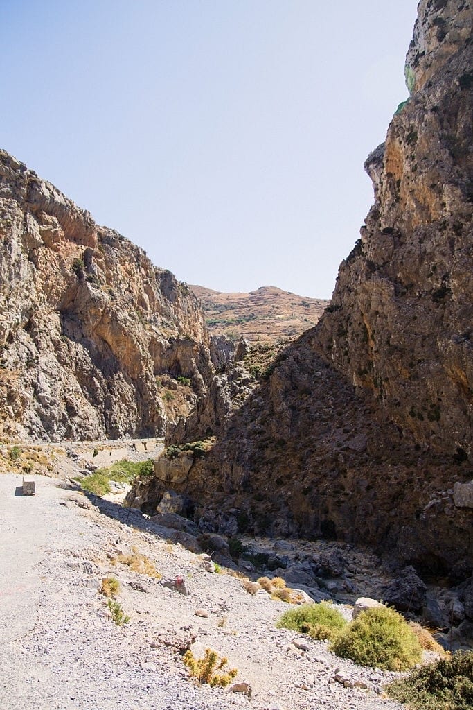
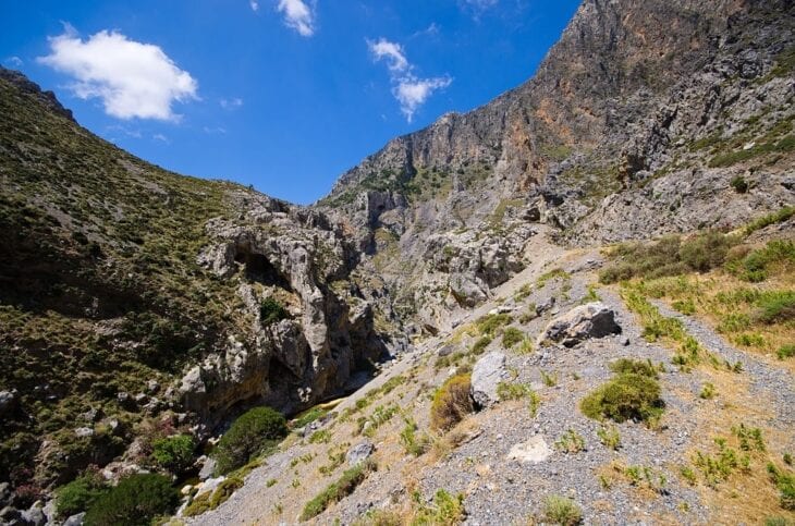
Kourtaliotiko Gorge is a 7 kilometers (4.35 miles) protected canyon in southwest Crete, open year-round (€5 ($5.81, £4.32)/day entry since 2025), best hiked in spring or autumn with a rental car. Kourtaliotiko Gorge took 5–10 million years to form between the Kouroupa and Xiron mountains, with limestone cliffs reaching 600 metres and a 40-metre waterfall near the chapel of Agios Nikolaos. Kourtaliotiko Gorge shelters Natura 2000-protected wildlife, including cliff-nesting raptors such as the Lammergeier (bearded vulture). Kourtaliotiko Gorge charges €5 ($5.81, £4.32)/day or €15 ($17.43, £12.95)/year for entry (since 2025), managed by OFYPEKA to fund conservation.
Hiking trails in Kourtaliotiko Gorge range from a 30-minute chapel descent (300 stone steps) to a 7 kilometers (4.35 miles), 4–7 hour route ending at Preveli Beach. Kourtaliotiko Gorge water stays cold year-round (1°C in spring to 14°C in summer), so children under 12 and visitors with mobility limits should stick to the upper viewpoints. Guided canyoning and river trekking tours improve safety on the lower sections.
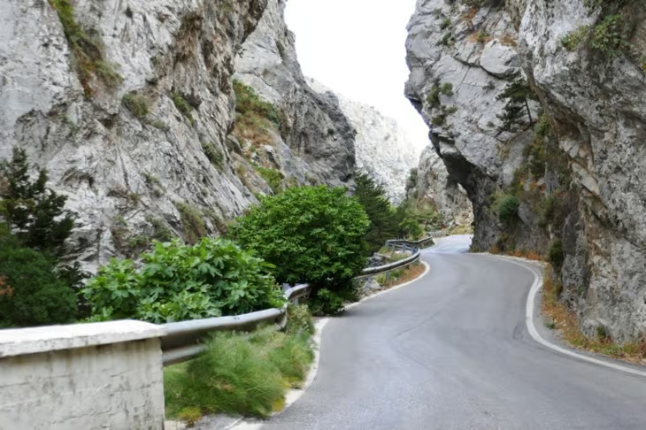
The best months to visit Kourtaliotiko Gorge are April–June and September–November, when temperatures stay between 15°C (59°F) and 25°C (77°F). Summer temperatures exceed 30°C (86°F) with limited shade, making early-morning visits (before 9 AM) essential. Winter increases flash-flood risk. Essential gear: sturdy hiking shoes, water shoes for the cold-water crossing, sun protection, 2+ litres of water, and a basic first aid kit. The fastest and most flexible way to reach Kourtaliotiko Gorge is by car rental – 35 minutes from Rethymno (25 kilometers (15.53 miles)) – because bus service is limited to two weekday departures. Rent a car in Crete costs €30 ($34.87, £25.91)–€60 ($69.73, £51.81)/day depending on vehicle type, rental company, and season.
Quick facts – Kourtaliotiko Gorge hike:
| Distance | 0.8 kilometers (0.50 miles) (chapel trail) to 7 kilometers (4.35 miles) (Preveli Beach) |
| Time | 30 min – 7 hours |
| Difficulty | Easy to strenuous |
| Entry fee | €5 ($5.81, £4.32)/day, €15 ($17.43, £12.95)/year (seniors 65+ free) |
| Water temp | 1°C (spring) – 14°C (summer) |
| Best season | April–June, September–November |
| Opening hours | Daily, ~8:00 AM to sunset (closed on fire-risk days) |
| Location | Between Kouroupa & Xiron mountains, 25 kilometers (15.53 miles) south of Rethymno |
| Coordinates | 35.1817° N, 24.4775° E (main trailhead, near Agios Nikolaos chapel) |
| Status | Natura 2000 Special Protection Zone (IBA GR183) |
What is Kourtaliotiko Gorge?
Kourtaliotiko Gorge is a 7 kilometers (4.35 miles) canyon in southwest Crete carved by the Kourtaliotis River between the Kouroupa and Xiron mountains, with 600-metre limestone cliffs and a 40-metre waterfall near the chapel of Agios Nikolaos. The gorge is named after the kourtala – clapping sounds created by wind funnelling through high caves near the northern entrance.

History and mythology
Kourtaliotiko Gorge served as a natural fortress and trade route during the Minoan era over 4,000 years ago. During the Middle Ages, the gorge connected villages, supported Roman aqueducts, and hosted ancient settlements. Local legend attributes the springs to Saint Nicholas, and chapels including Agios Nikolaos mark the gorge’s role in religious life. The most notable archaeological site inside the gorge is an abandoned village halfway through the route – stone houses, pathways, and agricultural terraces built by early settlers still survive.
Geology and formation
Kourtaliotiko Gorge took 5–10 million years to form: tectonic uplift cracked the limestone during the late Miocene, karstic weathering widened the fissures, and the Kourtaliotis River carved the final passage. Geological uplift continued to raise the stone floor while the river maintained its course through the terrain, producing the cliffs and narrow passages seen today.
Conservation and Natura 2000 status
Kourtaliotiko Gorge holds Natura 2000 status as a Special Protection Zone for Wild Birds – one of the highest conservation designations in the EU, managed by OFYPEKA (Natural Environment and Climate Change Agency). Kourtaliotiko Gorge is also classified as Important Bird Area GR183 by the Hellenic Ornithological Society and hosts the Lammergeier (bearded vulture), one of Europe’s rarest raptors, which uses the 600-metre cliffs as a roosting site.
Kourtaliotiko Gorge introduced a paid access system in 2025 – €5 ($5.81, £4.32)/day or €15 ($17.43, £12.95)/year – to manage visitor numbers and fund Natura 2000 conservation programmes. Seniors over 65 enter free. On fire-risk days the entry gates close and patrols increase.
Sources: Hellenic Ornithological Society, Important Bird Areas of Greece – GR183 Mount Kedros and Kourtaliotiko Gorge. Natural Environment and Climate Change Agency (OFYPEKA), 2025 access management programme.
Kourtaliotiko Gorge opening hours and entry
Kourtaliotiko Gorge opens daily from approximately 8:00 AM until sunset, with seasonal closures on high fire-risk days and during flash-flood warnings in winter. There are no fixed weekly closing days, but staffed access points were introduced in 2025, so opening hours are now actively managed at the entrance gate.
| Period | Opening hours | Notes |
|---|---|---|
| Spring (Apr–Jun) | 8:00 AM – ~8:30 PM | Best light for the waterfall; full water flow |
| Summer (Jul–Aug) | 8:00 AM – ~9:00 PM | Arrive before 9 AM to avoid heat (>30°C) and parking queues |
| Autumn (Sep–Nov) | 8:00 AM – ~7:30 PM | Quieter trails, mild weather |
| Winter (Dec–Mar) | 8:00 AM – ~6:00 PM | Closed during heavy rain or flash-flood warnings |
| Fire-risk days | Closed | Patrols increase; gates lock by order of OFYPEKA |
Entry fees (2026): €5 ($5.81, £4.32)/day or €15 ($17.43, £12.95)/year. Seniors aged 65+ enter free. Tickets are sold at the entrance gate; bring cash to avoid card-reader downtime in remote areas. Last entry is typically 1.5 hours before closing to allow time to descend, swim, and climb back. Always check posted opening hours at the gate before descending – local conditions may shorten the day’s window.
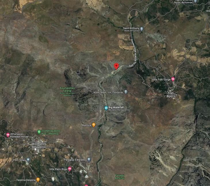
Kourtaliotiko Gorge map and location
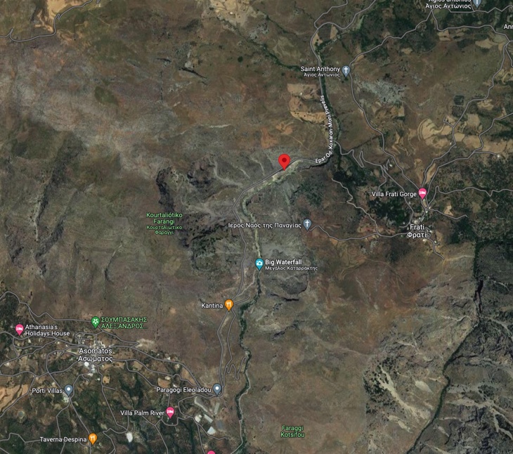
Kourtaliotiko Gorge runs north–south for 7 kilometers (4.35 miles) in southwest Crete, between the village of Koxare (north entrance, on the E97 Rethymno–Plakias road) and Preveli Beach (south outflow into the Libyan Sea). The main trailhead and Agios Nikolaos chapel sit at coordinates 35.1817° N, 24.4775° E, approximately 25 kilometers (15.53 miles) south of Rethymno and 9 kilometers (5.59 miles) north of Preveli Beach.
Key map landmarks (north to south):
| Landmark | Position on map | What you’ll find |
|---|---|---|
| Koxare village | North end (E97 road) | Last fuel stop and tavernas before the gorge |
| Stone arch + Kantina | Main trailhead, ~35.1817° N, 24.4775° E | Free parking (small lot), entry gate, ticket booth |
| Agios Nikolaos chapel | After 300-step descent | Upper waterfall viewpoint; trail split |
| Main waterfall (40 m) | Mid-gorge, riverbed level | Reached by 15 m swim through narrow passage |
| Abandoned Kourtaliotiko village | Halfway through the gorge | Stone houses, terraces, agricultural ruins |
| Megalos River bridge | South of waterfall | Trail continues toward Preveli on gravel paths |
| Preveli Palm Beach | South end (Libyan Sea) | Trail terminus, palm forest, river estuary |
The full Kourtaliotiko map is searchable on Google Maps under “Kourtaliotiko Gorge” or “Kourtalis Gorge”; the road stop with parking is marked under the Kantina pin near the stone arch. Two route options appear on the map: the short waterfall loop (chapel + waterfall, return to trailhead) and the long Preveli traverse (one-way, requires car shuttle or return hike). Mobile reception is patchy inside the gorge – download the offline Google Maps area or carry a printed map before descending.
Kourtaliotiko Gorge waterfalls
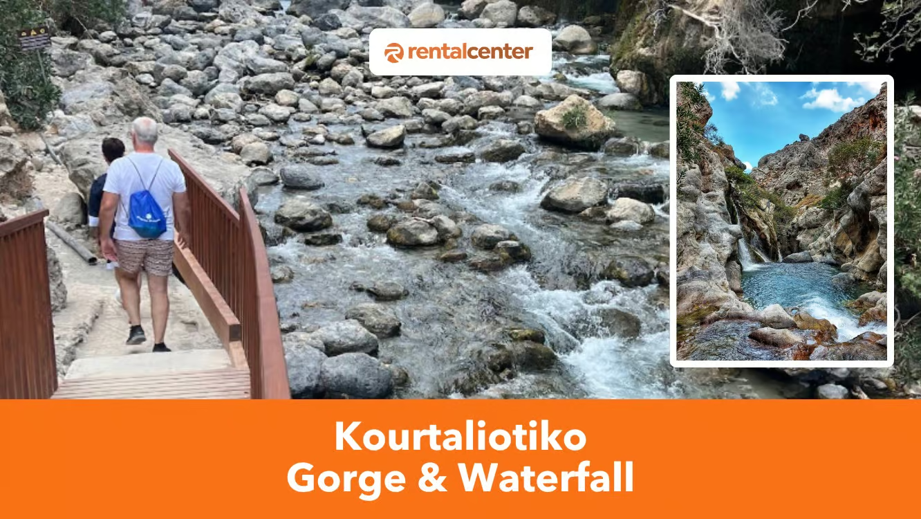
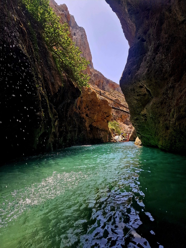
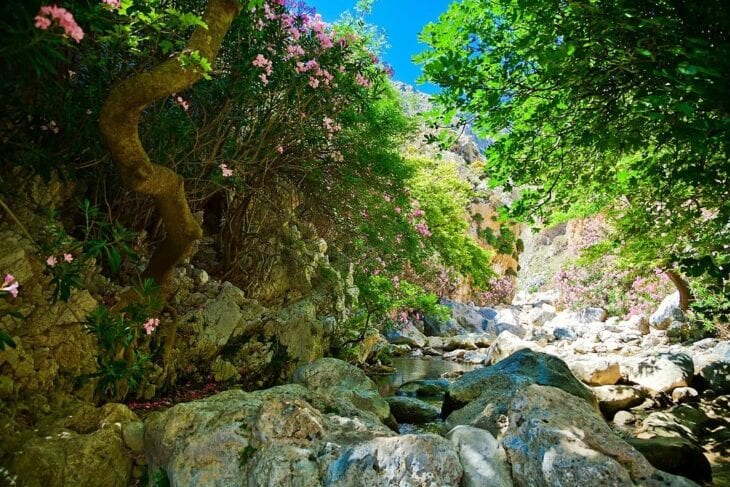
Kourtaliotiko Gorge contains one main 40-metre waterfall (the most photographed cascade in southwest Crete), plus several seasonal cascades and pools fed by the Kourtaliotis River along the lower gorge route. Water temperature ranges from 1°C in spring to 14°C in summer, and the main waterfall is reached only by swimming ~15 metres through a narrow, cold-water passage.
Three waterfalls and pools to know on the route:
| Cascade | Height | Location | Access |
|---|---|---|---|
| Main Kourtaliotiko Waterfall | ~40 m | Mid-gorge, below Agios Nikolaos chapel | 300-step descent + 15 m swim through narrow passage |
| Upper cascade pools | 1–3 m drops | Above the main fall, near the chapel | Visible from the upper viewpoint, no swim required |
| Lower seasonal cascades | Variable | Megalos River section toward Preveli | Reached only via the 7 kilometers (4.35 miles) hike to Preveli Beach |
The main waterfall sits at the bottom of the gorge, accessible through a carved staircase from the road stop marked on Google Maps. The Kourtaliotis River feeds the cascade in the darkest part of the gorge – water flow peaks in spring (April–May) and is strongest after winter rains. By late summer the smaller seasonal cascades may dry up, but the main 40-metre waterfall flows year-round.
How to reach the main waterfall (swimming required)
Two viewpoints exist for the Kourtaliotiko waterfall:
- From above – near the small chapel of Agios Nikolaos (no swim required, accessible via the 300-step descent).
- From below – only after swimming through the narrow gorge passage. The swim is approximately 10–15 metres long and leads to the inner chamber where the waterfall can be fully experienced. The water is crystal-clear but freezing year-round, so non-slip water shoes are essential.
Is swimming in the Kourtaliotiko waterfall allowed in 2025?
Swimming to the waterfall cave is technically possible but strongly discouraged in 2025. Kourtaliotiko Gorge is a Natura 2000 protected zone, and OFYPEKA discourages swimming in the waterfall cave to protect the freshwater ecosystem. The swim ban is debated – some locals report it is not formally enforced as of September 2025, while conservation advocates support restricting access. To be safe, check conditions at the entrance gate before descending.
Environmental responsibility: Kourtaliotiko Gorge is a Natura 2000 protected zone. Visitors are asked not to use sunscreen before swimming (chemical pollution risk to the freshwater ecosystem), not to litter, and to keep noise low near cliff faces where protected birds nest. Irresponsible parking has previously blocked emergency vehicle access – use the official car parks only.
Kourtaliotiko Gorge hike
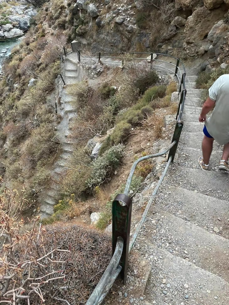
The main gorge hike ranges from 30 minutes (chapel viewpoint, easy) to 7 hours (Preveli Beach, strenuous); 300–400 stone steps mark the descent and the climb back.
Safety notice: Kourtaliotiko Gorge involves steep stone steps (300–400), uneven terrain, and cold water crossings (1–14°C). Swimming to the waterfall requires passing through a narrow, deep-water passage where standing is not possible. This hike is not suitable for young children, visitors with mobility limitations, or anyone without swimming confidence. On fire-risk days the gorge closes entirely – check conditions at the entrance gate before descending.
How difficult is the hike?
Hiking in Kourtaliotiko Gorge ranges from easy to strenuous depending on the route. The descent starts with 300 stone steps, manageable for most people. The 2 kilometers (1.24 miles) trail to the waterfall adds rock scrambling and a swim in 1°C water. The full 7 kilometers (4.35 miles) hike to Preveli Beach crosses rugged terrain and unmarked trails over 4 hours. Shorter routes suit moderately fit adults with proper shoes; longer hikes require high fitness, navigation skills, and endurance.
Suitability:
- Elderly hikers (good fitness): Yes for the 300-step descent and chapel trail. Avoid rock scrambling and cold-water swims. Seniors over 65 enter free.
- Children under 12: No for the swim section; supervised viewpoint visits only.
- Children over 12 (with hiking experience): Chapel trail and shallow waterfall pool with adult supervision.
A guide is not required for the main trails (well-marked, self-guided friendly), but a guide adds value for rock scrambling, cold-water crossings, and the unmarked path to Preveli Beach.
Hiking routes: waterfall trail vs Preveli Beach trail
Two main routes start from the same trailhead:
- Kourtaliotiko Church and Waterfall Route (short, 2 kilometers (1.24 miles)). The trail descends 300 paved steps into the gorge. At the split, the left path leads to the Church of Agios Nikolaos (built into the gorge wall, panoramic viewpoints). The right path leads to the riverbed and the waterfall pool. Hikers navigate rocks and water pipes before swimming 15 metres through 1°C water in non-slip water shoes. Round trip: 1.5–2 hours.
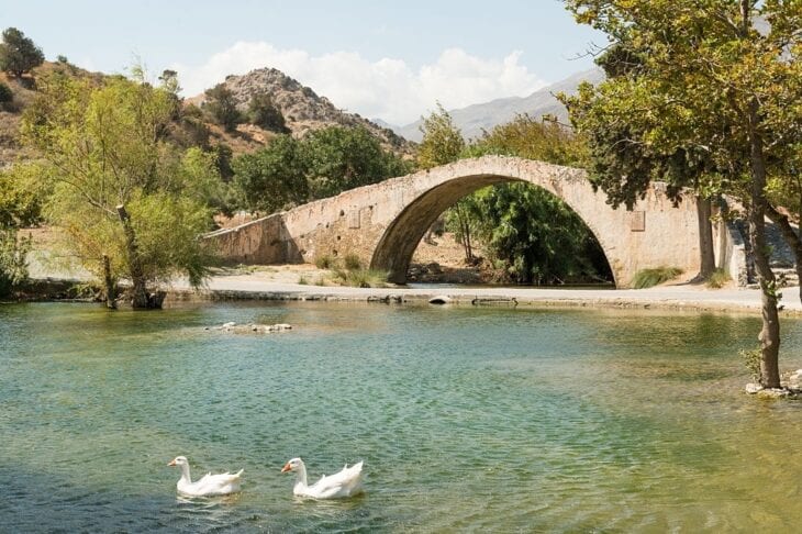
- Kourtaliotiko Waterfall to Preveli Beach (long, 7 kilometers (4.35 miles)). Starts at the waterfall and follows the Kourtaliotis River as it transitions into the Megalos River. The terrain includes uneven paths, water crossings, and rock scrambling. A bridge crosses the Megalos River midway, and the route ends at Preveli Palm Beach (clear water, fine sand, the second-largest palm forest in Crete). Total time: 4–7 hours one way.

Commercial canyoning and river trekking tours are available through local operators and platforms such as GetYourGuide – guided groups can access sections of the gorge inaccessible to independent hikers, including parts of the Megalos River below the falls.

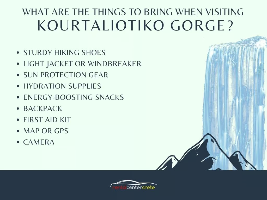
What to bring when visiting Kourtaliotiko Gorge
Pack the following essentials before visiting Kourtaliotiko Gorge:
- Sturdy hiking shoes for rocky paths and muddy sections.
- Water shoes for the cold-water swim through the waterfall passage.
- Light jacket or windbreaker – weather changes quickly in the gorge.
- Sun protection – hat, sunglasses, and reef-safe sunscreen (regular sunscreen pollutes the freshwater ecosystem).
- 2+ litres of water per person, plus electrolyte tablets for summer hikes.
- Energy snacks – fruit, nuts, or energy bars.
- Backpack to carry gear hands-free (essential for the climb back).
- Basic first aid kit for blisters, scrapes, and minor injuries.
- Map or GPS – trails are marked but reception is patchy in the gorge.
- Camera – the chapel viewpoint and waterfall chamber are the highlights.
Getting to Kourtaliotiko Gorge
The fastest and most flexible way to reach Kourtaliotiko Gorge is by car – 35 minutes from Rethymno (25 kilometers (15.53 miles)) – because bus service is limited to two weekday departures.
By car (recommended)
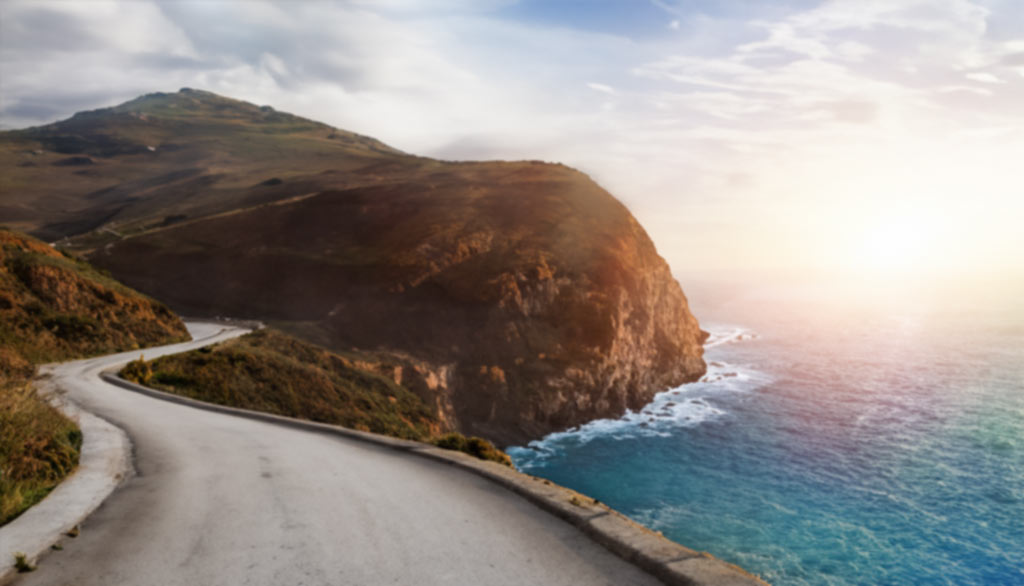
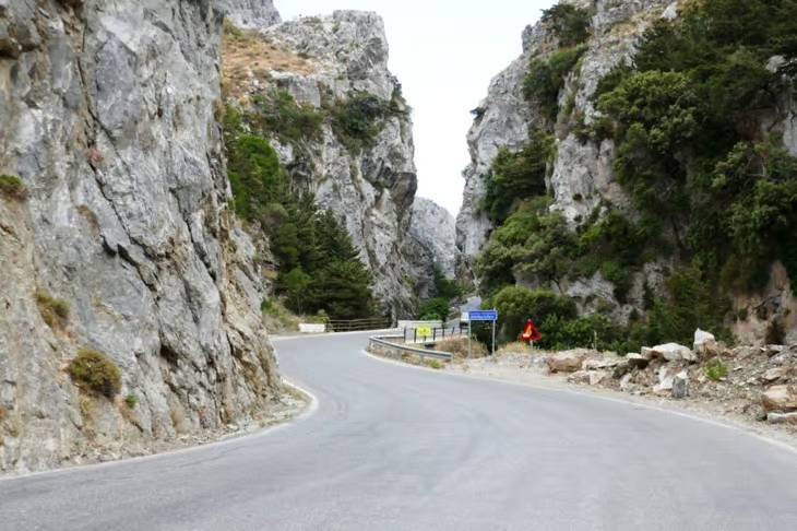
Driving from Rethymno: 25 kilometers (15.53 miles), 35 minutes via a scenic motorway through olive farms and mountain landscapes. From Chania: 8 kilometers (49.71 miles), 1 hour 15 minutes. From Heraklion: 105 kilometers (65.24 miles), 1.5 hours. Crete Car rental cost €30 ($34.87, £25.91)–€60 ($69.73, £51.81)/day depending on vehicle type, rental company, and season.
By bus, taxi, or guided tour
| Option | From Rethymno | From Chania / Heraklion | Best for |
|---|---|---|---|
| KTEL bus | €4.5 ($5.23, £3.89), transfer at Asomatos + 1.5 kilometers (0.93 miles) walk | Bus to Rethymno first, then transfer | Budget travellers staying overnight in Rethymno or Plakias |
| Taxi | €26 ($30.22, £22.45)–€32 ($37.19, £27.63) | €80 ($92.98, £69.08)–€130 ($151.09, £112.26) | Visitors without driving licences |
| Guided tour | Included transport + hike + Preveli Beach | Pickup from major resorts | First-time visitors, no logistics |
Bus service from Rethymno runs only twice on weekdays and once on Sundays, so the bus option requires careful planning.
Parking at Kourtaliotiko Gorge
The main parking area sits next to the Kantina roadside stop, beside the stone arch marking the trailhead. It is free but small (only a few spaces). Arrive before 10 AM in spring and summer, otherwise overflow parking along the road causes congestion and adds walking distance. A larger parking lot has been built uphill from the main entrance – more spaces and less crowded during off-peak times.
Should you hire a vehicle to visit Kourtaliotiko Gorge?
Yes – a rental car makes it possible to combine Kourtaliotiko Gorge, Preveli Beach (9 kilometers (5.59 miles) south), and Preveli Monastery (8.5 kilometers (5.28 miles)) in a single day, a route impossible by bus due to limited weekend service. The drive also passes through olive groves, mountain roads, and traditional villages, so the journey is part of the experience.

Best vehicle types for this trip:
- Compact SUVs (Peugeot 2008, Skoda Kamiq) – best balance for the narrow approach road; ground clearance, 5-passenger space.
- Economy cars (Toyota Aygo, Peugeot 108) – fuel-efficient and easy to park near the gorge; suit solo travellers or couples on a budget.
- Large SUVs (Toyota RAV4, Volvo XC90) – comfort and luggage space for families.
- Minibuses (Volkswagen Caddy Maxi, Fiat Doblò) – up to 7 passengers, ideal for groups with hiking gear.
Roads near Kourtaliotiko Gorge are paved but narrow and winding, so compact cars and SUVs offer better manoeuvrability and easier parking. Rental Center Crete is the best local car rental company and offers competitive rates.
What is the average cost of a Crete car hire?
Crete car rental costs vary by group size, itinerary, vehicle type, destination, and duration. Average daily rate: €25 ($29.06, £21.59)–€40 ($46.49, £34.54). Weekly rental: ~€250 ($290.55, £215.88). Weekend rental: ~€78 ($90.65, £67.35). Bring all required driving documents (licence, ID/passport, credit card) before booking.

Nearby attractions to Kourtaliotiko Gorge
Within 12 kilometers (7.46 miles) of the gorge: Preveli Beach (9 kilometers (5.59 miles), palm forest), Preveli Monastery (8.5 kilometers (5.28 miles), 16th century), Plakias village (9 kilometers (5.59 miles)), and Spili’s Venetian fountain (12.5 kilometers (7.77 miles)).

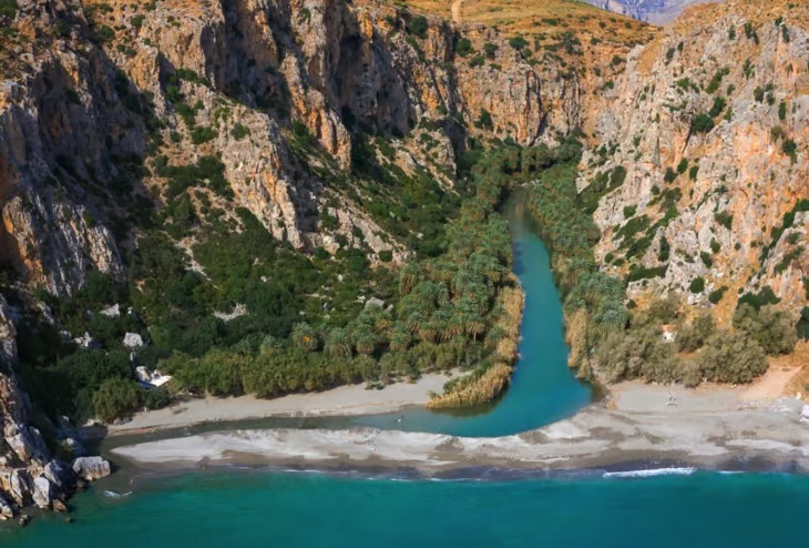
Preveli Beach
Preveli Beach is 9 kilometers (5.59 miles) from Kourtaliotiko Gorge and features golden sand, crystal-clear water, and Crete’s second-largest palm forest at the estuary where the Megalos River meets the Libyan Sea. Visitors can swim, sunbathe, or explore the palm grove. Preveli Beach is accessible by hiking from Kourtaliotiko Gorge or by direct road.

Preveli Monastery
Preveli Monastery lies 8.5 kilometers (5.28 miles) south of Kourtaliotiko Gorge. Founded in the 16th century, the monastery sits on a cliff overlooking the Libyan Sea and features historic architecture, religious relics, and tranquil gardens.
Plakias and Spili Village
Plakias beach lies 9 kilometers (5.59 miles) from Kourtaliotiko Gorge – sandy shoreline, traditional tavernas, and shops with handmade goods, perfect for a post-hike meal or swim. Spili Village lies 12.5 kilometers (7.77 miles) from the gorge and is known for the Venetian-era Kefalovrysi Fountain (25 lion-head spouts), historic churches, a botanical garden, and tavernas serving traditional Cretan cuisine, olive oil, and honey.
Where to stay and eat near Kourtaliotiko Gorge
The closest accommodation to Kourtaliotiko Gorge starts from €80 ($92.98, £69.08)/night (Villa Frati Gorge, 3.2 kilometers (1.99 miles)); the closest restaurant is Taverna Despina in Asomatos, 3 kilometers (1.86 miles) away.

Accommodation options
| Property | Distance | From / night | Highlights |
|---|---|---|---|
| Villa Frati Gorge | 3.2 kilometers (1.99 miles) | €80 ($92.98, £69.08) | Garden, pool, palm-shaded BBQ areas, olive grove views |
| Villa Despina | 2.4 kilometers (1.49 miles) (Asomatos) | €215 ($249.87, £185.65) | Air-conditioned rooms with private pools, full kitchens, Wi-Fi |
| Villa Erofili | 2.5 kilometers (1.55 miles) (Asomatos) | €126 ($146.44, £108.80) | 2–4 bedroom units, Jacuzzi, sea/mountain views, hiking & diving nearby |

Restaurants and tavernas
| Tavern | Distance | Specialties | Price range |
|---|---|---|---|
| Gefyra Tavern | 8 kilometers (4.97 miles) (by Venetian bridge) | Cretan & Mediterranean – grilled lamb chops, slow-cooked lamb, fresh seafood | Starters €5 ($5.81, £4.32)–€8 ($9.30, £6.91) / Mains €10 ($11.62, £8.64)–€18 ($20.92, £15.54) |
| Taverna Despina | 3 kilometers (1.86 miles) (Asomatos) | Rabbit in tomato sauce, veal stew, stuffed vegetables; vegetarian/vegan/GF options | Full meal for 3: €40 ($46.49, £34.54)–€50 ($58.11, £43.18) |
| Plakias Bay Restaurant | 9 kilometers (5.59 miles) (Plakias) | Greek & Cretan – same-day seafood, stuffed vine leaves, tzatziki, grilled lamb | €10 ($11.62, £8.64)–€20 ($23.24, £17.27) per meal |
What visitors say about Kourtaliotiko Gorge
Visitors consistently rate Kourtaliotiko Gorge as one of the most dramatic hiking destinations in Crete, while warning that the cold water (~1°C in spring) is the main barrier to reaching the falls.
Recurring praise: limestone cliffs, waterfalls, clear pools, scenic wildflower meadows, ancient plane trees, and mountain views. Swimming in the 1–15°C waterfall is described as “exhilarating”, with ropes assisting through strong currents. Guided river trekking and canyoning tours score high on safety and access to hidden areas.

Tips for first-time visitors
- Cold water shock: Spring water can drop to 1°C – wear water shoes and limit immersion time.
- Summer crowds: Arrive before 10 AM (and before 9 AM in July–August) for parking and quieter pools.
- Slippery terrain: The waterfall approach has wet rocks and water pipes – non-slip footwear is essential.
- No sunscreen before swimming: Use reef-safe sunscreen, or apply after the swim, to protect the freshwater ecosystem.
- No littering: The gorge is a protected Natura 2000 site – pack everything out.
- Climb back is harder than the descent: Pace yourself and bring extra water.

Written by Harry Anapliotis – Owner of Rental Center Crete, a car hire company operating in Crete since 1975 and officially licensed by the Greek National Tourism Organization (License #1039E00810009100). Harry has been driving Crete’s mountain roads – including the approach to Kourtaliotiko Gorge – for over five decades and writes practical travel guides based on direct local knowledge.
Published on .