




This guide ranks the 7 best gorge hikes in Crete, from the most famous to the most off-the-beaten-path, then covers 5 more hikes worth considering for advanced, coastal, and monastery routes. The best hiking season runs April to June and September to October, when temperatures stay below 28°C (82°F) and the gorges are fully open. A scheduled KTEL bus runs daily from Chania to the Samaria trailhead, but bus coverage to the smaller gorges is minimal to nonexistent, which is where a Crete rental car, especially a one-way pickup in one town and drop-off in another, earns its keep.
Safety disclaimer: Trail conditions, entrance fees, and bus/ferry timetables change seasonally. Always verify with the Samaria Gorge management or the Region of Crete tourism portal before setting out. In a trail emergency, call the European emergency number 112 – Greek mountain rescue responds via this line.
What Makes Hiking in Crete Special?
Crete packs limestone gorges, coastal cliffs, and summits over 2,000 m onto a single island, with more than 50 marked trails within driving distance of the main towns. Three mountain ranges anchor the island’s hiking: the Psiloritis range in the centre, home to Mount Ida at 2,456 m; the Lefka Ori (White Mountains) in the west, where Samaria and Imbros cut through; and the Dikti Mountains in the eastern Lasithi region. The E4 European long-distance path crosses the island too, linking the Sitia Geopark in the east, the Zakros gorge and palace site, and the car-free coastal trail between Loutro and Chora Sfakion in the south-west.
| Region | Main trailheads | Best for |
|---|---|---|
| Chania (west) | Samaria, Imbros, Agia Irini, Aradena | Big-name gorge hikes |
| Rethymno (centre) | Kourtaliotiko, Patsos, Mili | Shorter half-day hikes |
| Heraklion (centre) | Rouvas, Psiloritis summit | Mountain hikes |
| Lasithi (east) | Zakros, Richtis, Katholiko | History + waterfalls |
Best Season and Practical Tips for Hiking in Crete
The best months to hike in Crete are April to June and September to October, when temperatures stay below 28°C and the gorges are fully open. July and August turn hot enough (35°C+) that Samaria becomes dangerously crowded at midday. November to March brings rain, and most high-altitude gorges close, though Imbros and Agia Irini stay walkable on dry days.
When to Hike in Crete?
- April–June: Peak wildflowers, comfortable temperatures, all gorges open from mid-May.
- September–October: Cooler, fewer crowds, sea still warm for the post-hike swim.
- July–August: Avoid Samaria unless you start at first light. Stick to short, shaded gorges (Patsos, Richtis).
- November–March: Stick to coastal walks and low-altitude trails; Samaria National Park is closed.
What to Wear and Bring?
- Sturdy hiking boots or trail shoes – gorge floors are uneven limestone. Sandals are not recommended.
- 2 litres of water per person minimum – Samaria has refill springs; most other gorges do not.
- Sun hat, sunscreen, sunglasses – most gorges have long unshaded stretches.
- Light rain jacket in shoulder season – squalls move in fast from the Libyan Sea.
- Phone with offline map – download the trail before you leave the hotel; mobile coverage drops in deeper gorges.
Getting to Trailheads by Car
Most Cretan gorges are point-to-point hikes, so your car ends up at the wrong end of the trail unless you plan for it. Three options work:
- One-way car hire – pick up in Chania, drop off in a different town. Rental Center Crete supports one-way hire between Heraklion (Nikos Kazantzakis) Airport, Chania (Ioannis Daskalogiannis) Airport, Rethymno, and Sitia, including pickups for travellers arriving by ferry to Crete.
- Park at the exit, bus to the entry – KTEL buses run from Chania to the Xyloskalo trailhead each morning; you walk down to Agia Roumeli and ferry back.
- Park at the entry, taxi or bus back – works well for Imbros (small village taxi network) and Aradena (limited).
Entrance Fees and Opening Dates
| Gorge | Fee | Open |
|---|---|---|
| Samaria | €5 ($5.74, £4.24) (adults), free under 15 | About 1 May to 31 October |
| Imbros | €2 ($2.30, £1.70) to €3 ($3.44, £2.54), seasonal | Year-round (dry days) |
| Agia Irini | €2 ($2.30, £1.70) to €3 ($3.44, £2.54), seasonal | March to November |
| Aradena | Free | Year-round (advanced only) |
| Patsos / Agios Antonios | Free | Year-round |
| Kourtaliotiko | Free | Year-round |
| Zakros | Free | Year-round |
| Richtis | Free | March to November |
Always reconfirm at the gate, since fees change yearly.
Safety on Crete Trails
- Flash flood risk: Do not hike any gorge during or immediately after heavy rainfall. Water rises fast inside narrow canyons.
- Rockfall risk: Avoid hiking in high winds, especially in Samaria’s Iron Gates and Aradena’s narrow sections.
- Heat exhaustion: Start hikes by 7 a.m. in summer. Carry oral rehydration salts.
- Mobile signal drops in deep gorges. Tell someone your route and expected exit time.
- Donkey rescue and km markers exist in Samaria; other gorges have none, so turn back if injured.
The 7 Best Gorge Hikes in Crete
These 7 gorge hikes cover the full range of difficulty, from a 45-minute family walk at Zakros to the 7-hour Samaria Gorge, Europe’s longest. They are ranked from most famous to most off-the-beaten-path.
1. Samaria Gorge – The Must-Do
Samaria Gorge – Quick Facts
- Distance: 17.5 kilometers (10.87 miles) one-way (often described as 16 kilometers (9.94 miles) – the last 1.5 kilometers (0.93 miles) from old Agia Roumeli to the ferry adds up)
- Elevation loss: 1,230 m (steepest first 6 kilometers (3.73 miles): -800 m)
- Difficulty: Moderate–Hard
- Hiking time: 5–7 hours
- Season: About 1 May to 31 October (closure dates posted at samaria.gr)
- Entrance fee: €5 ($5.74, £4.24) park entry + €10 ($11.48, £8.48) ferry return from Agia Roumeli
- Trailhead: Xyloskalo, Omalos Plateau (1,250 m elevation)
- Transport: KTEL bus from Chania to Omalos, ferry from Agia Roumeli to Chora Sfakion or Paleochora, bus back to Chania
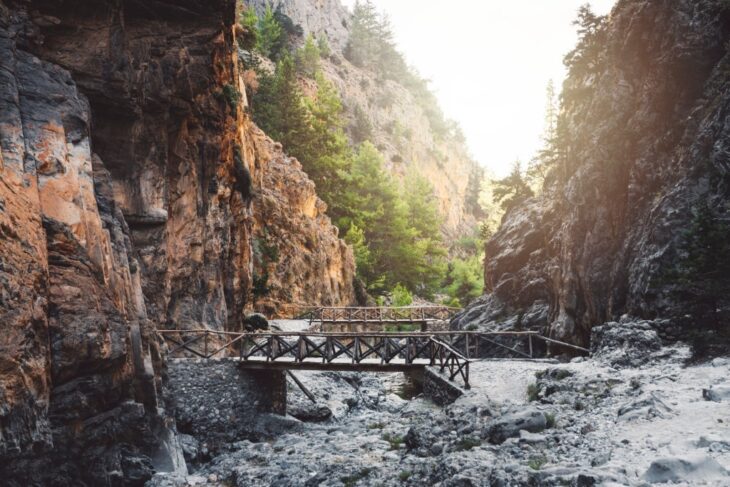
Samaria Gorge draws more hikers than any other trail in Greece, over 100,000 visitors per season, and the reputation holds up. Starting at Xyloskalo on the Omalos Plateau, the first 6 kilometers (3.73 miles) drop 800 metres through pine forest along a wooden-stepped switchback, the most demanding stretch and the section that surprises unprepared visitors.
After the descent, the trail flattens onto the riverbed and follows a cool brook past the abandoned village of Samaria. As the trail nears the Libyan Sea, the Iron Gates narrow to just 4 metres wide with 300-metre walls overhead, the iconic Samaria photograph. The hike ends in the seaside village of Agia Roumeli; there’s no way to drive out, so plan the ferry to Chora Sfakion or Paleochora before you start. Samaria Gorge has held national park status since 1962 and carries UNESCO Biosphere Reserve recognition, according to the official visitor information at samaria.gr.
2. Imbros Gorge – Best for Families
Imbros Gorge – Quick Facts
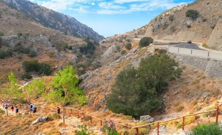
- Distance: 8 kilometers (4.97 miles) one-way
- Elevation loss: 600 m
- Difficulty: Easy–Moderate
- Hiking time: 3–4 hours
- Season: Year-round (dry conditions only)
- Entrance fee: €2 ($2.30, £1.70) to €3 ($3.44, £2.54), seasonal
- Trailhead: Imbros village, on the Chania–Sfakia road
- Transport: Car to Imbros village; taxi or bus back from Komitades (3 kilometers (1.86 miles) from Hora Sfakion)
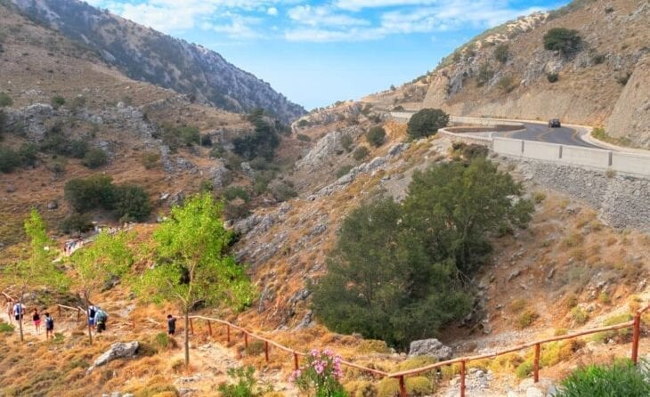
Imbros Gorge runs 8 kilometers (4.97 miles) through the Chania mountains, the closest major gorge hike to the city. It works as the natural alternative to Samaria for families and anyone who wants dramatic gorge scenery without the seven-hour commitment: the descent is gentler, the trail is wider, and the gorge stays open year-round on dry days. Imbros Gorge charges a small entrance fee, around €2 ($2.30, £1.70) to €3 ($3.44, £2.54), during the summer season.
The narrowest passage of Imbros Gorge squeezes hikers between vertical walls just 2 metres apart. Imbros also carries historical weight: in WWII, New Zealand and Australian troops evacuated through this gorge en route to Hora Sfakion and boats to Egypt, and interpretive plaques mark key points along the trail.
3. Agia Irini Gorge – Best Off-the-Beaten-Path
Agia Irini Gorge – Quick Facts
- Distance: 7.5 kilometers (4.66 miles) one-way
- Elevation loss: 560 m (descent from village to sea)
- Difficulty: Easy–Moderate
- Hiking time: 2.5–3 hours
- Season: March to November
- Entrance fee: €2 ($2.30, £1.70)
- Trailhead: Agia Irini village, 45 kilometers (27.96 miles) south of Chania
- Transport: Car to Agia Irini; pick-up arranged from Sougia beach
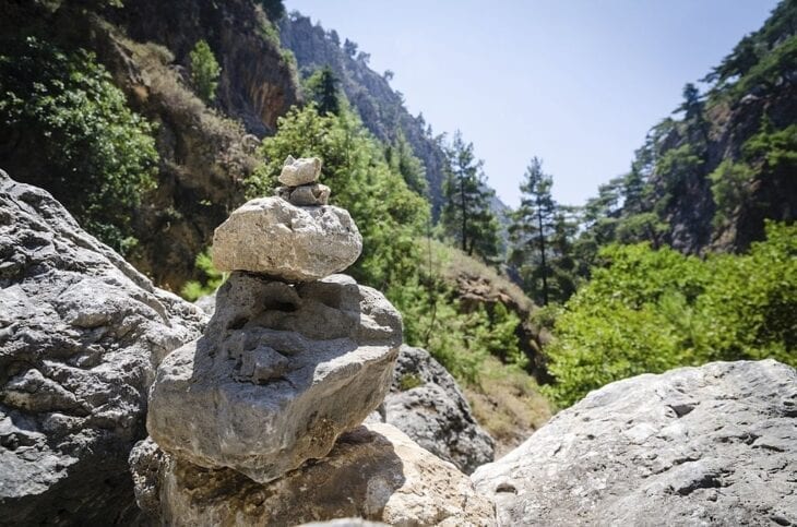
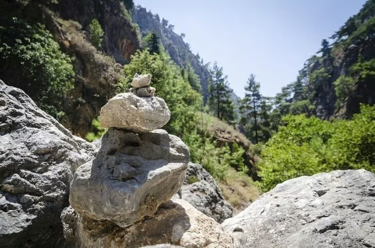
Agia Irini starts at 560 m elevation in the village of the same name and descends 7.5 kilometers (4.66 miles) to the Libyan Sea at Sougia beach, a moderate 2.5 to 3-hour hike. Unlike Samaria, the trail rarely sees crowds, which keeps it one of Crete’s best-kept hiking secrets.
The path passes through wild herbs, olive groves, and exposed limestone, more open and sun-drenched than the shaded Samaria route. Sougia at the end is a low-rise village with tavernas right on the pebble beach, ready for an afternoon swim before the bus or pre-arranged car pick-up back.
4. Kourtaliotiko Gorge – Most Scenic
Kourtaliotiko Gorge – Quick Facts

- Distance: About 3 kilometers (1.86 miles) gorge, plus the walk to Preveli (about 5 kilometers (3.11 miles) total)
- Wall height: Up to 500 m
- Difficulty: Moderate (river-wading section)
- Hiking time: 3–4 hours
- Season: Year-round (best May–October when the river is shallow)
- Entrance fee: Free
- Trailhead: Kourtaliotiko bridge, south of Plakias, Rethymno region
- Transport: Car essential, no scheduled bus service
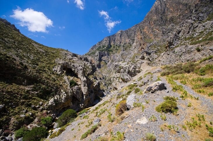
Kourtaliotiko Gorge rewards hikers with Crete’s second-largest palm forest and a river wade before reaching Preveli Beach. The Megalopotamos river runs the length of the gorge; in summer it stays shallow and refreshing, while in winter and spring it can run too deep to cross safely.
The gorge takes its musical name “Kourtaliotiko” from the castanet-like clatter of wind through cliffside caves and the rush of the river below. Cliff walls reach 500 m, and towards the river mouth, the trail opens into the Preveli palm forest before reaching the south coast.
5. Patsos / Agios Antonios Gorge – Best Short Hike
Patsos Gorge – Quick Facts
- Distance: 2 kilometers (1.24 miles) one-way
- Elevation change: 240 m
- Difficulty: Easy
- Hiking time: About 1 hour
- Season: Year-round
- Entrance fee: Free
- Trailhead: Patsos village, Amari valley, Rethymno region
- Transport: Car only, narrow mountain roads from Rethymno (45 min)
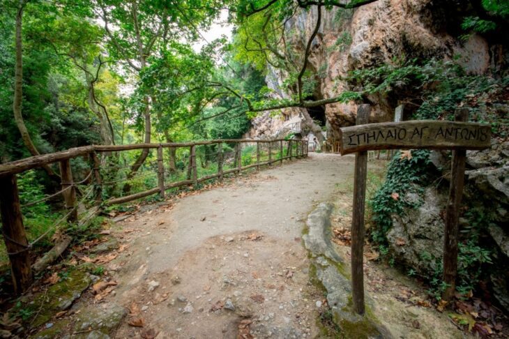
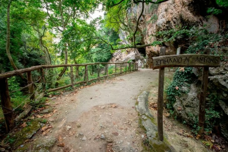
At just 2 kilometers (1.24 miles) and 240 m of elevation change, Patsos Gorge, also called Agios Antonios, ranks as Crete’s most accessible hike, a one-hour morning walk near Rethymno. The trail runs along a shaded river, with rest points and even a birdwatching post along the way.
The gorge takes its name from a cave church of Saint Anthony (Agios Antonios) built directly into the cliff wall, an unusual sight that gives the trail a contemplative character. Combine the hike with a visit to Arkadi Monastery, 30 minutes’ drive north, for a half-day cultural itinerary.
6. Zakros Gorge (Valley of the Dead) – Best for History
Zakros Gorge – Quick Facts
- Distance: About 3 kilometers (1.86 miles) gorge proper (extends to 7 kilometers (4.35 miles) from Ano Zakros)
- Elevation loss: About 100 m (about 400 m from Ano Zakros)
- Difficulty: Easy (from the gorge entrance); Moderate (from Ano Zakros)
- Hiking time: About 45 minutes (gorge only); about 2 hours (full route from Ano Zakros)
- Season: Year-round
- Entrance fee: Free
- Trailhead: Below Ano (Upper) Zakros village, Lasithi region (far eastern Crete)
- Transport: Car only, 45-minute drive from Sitia
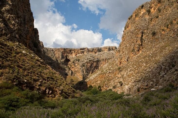
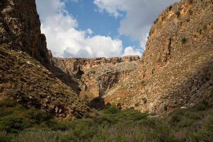
Zakros Gorge carves through east Crete’s Sitia Geopark, connecting the village of Ano Zakros to a Minoan palace site on the Libyan Sea at Kato Zakros. The alternative name, “Valley of the Dead,” sounds ominous but reflects an honour: the Minoans buried their dead in caves high on the gorge walls, in the place of greatest reverence. The site at the gorge mouth was a prosperous Bronze Age trade centre, now excavated and open to visitors.
Zakros also belongs to the E4 European long-distance walking path and the Sitia UNESCO Global Geopark, a protected region of rare biotopes and endemic flora. Most hikers enter just above the palace for the easy 45-minute walk; the full two-hour route starts at Ano Zakros.
7. Richtis Gorge – Hidden Waterfall
Richtis Gorge – Quick Facts
- Distance: About 3 kilometers (1.86 miles)
- Elevation loss: About 30 m (gentle)
- Difficulty: Easy
- Hiking time: About 1.5 hours
- Season: March to November
- Entrance fee: Free
- Trailhead: Exo Mouliana, north Lasithi (outside Sitia)
- Transport: Car to trailhead; the exit is a separate beach access road
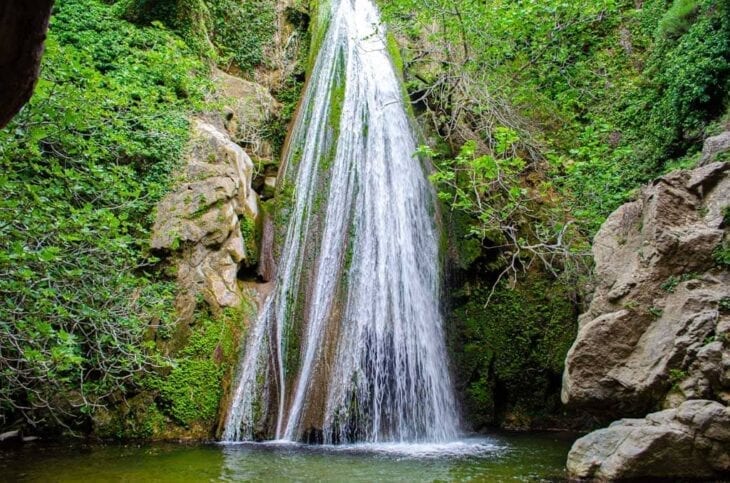
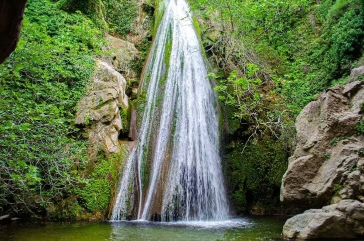
Richtis Gorge in the Lasithi region, just outside Sitia, runs 3 kilometers (1.86 miles) past the ruins of historic stone water mills and abandoned shepherds’ cottages. Richtis Gorge trail stays shady, green, and easy on the legs, and at the midpoint it delivers Crete’s hidden treasure: a 20-metre waterfall that splashes into a deep swimming pool suitable for a mid-hike dip. The gorge ends at a quiet pebble beach on the north coast, ready for a swim before the drive back to Sitia.
More Hikes Worth Considering
Beyond the 7 main gorges, Crete has advanced, coastal, and monastery hikes that most visitors never discover. This guide’s 7 headline hikes are only a start; Crete holds more than 40 named gorges in total, and our companion guide to Crete’s gorge walks ranks 24 of them by difficulty and distance.
8. Aradena Gorge (Advanced)
Aradena Gorge – Quick Facts
- Distance: About 6 kilometers (3.73 miles) one-way, with iron ladders on the steepest sections
- Difficulty: Hard
- Hiking time: 3–4 hours
- Trailhead: Abandoned village of Aradena
- Transport: Car or taxi to Aradena; water taxi back from Marmara Beach
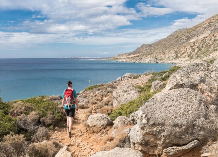
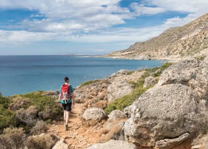
Aradena Gorge descends from the abandoned village of Aradena to Marmara Beach, with iron ladders bolted into the rock for the steepest sections. The route suits neither vertigo sufferers nor families with young children. Allow 3 to 4 hours, and combine the hike with a ferry from Marmara to Loutro to fill a full day.
9. Katholiko Monastery Hike
Katholiko Monastery Hike – Quick Facts
- Distance: About 2 kilometers (1.24 miles) descent
- Difficulty: Easy–Moderate
- Hiking time: About 2 hours round-trip
- Trailhead: Akrotiri peninsula plateau, near Chania Airport
- Entrance fee: Free
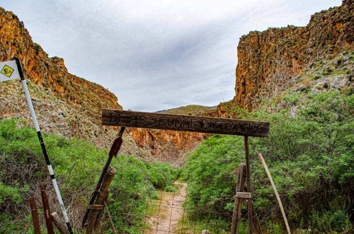
The Katholiko Monastery hike descends from the Akrotiri peninsula plateau, near Chania Airport, past the ruins of the 16th-century Katholiko Monastery, into a hidden gorge that ends at Katholiko Bay, a narrow turquoise inlet. Swimming there is prohibited: the site sits on private monastery grounds set aside for pilgrims and walkers, not sunbathers. The hike makes a useful add-on for travellers spending a night near Chania.
10. Mili Gorge (Near Rethymno)
Mili Gorge – Quick Facts
- Distance: About 3 kilometers (1.86 miles)
- Difficulty: Easy
- Hiking time: About 1.5 hours
- Trailhead: 7 kilometers (4.35 miles) south of Rethymno town
- Entrance fee: Free
Mili Gorge follows an old watermill canyon just 7 kilometers (4.35 miles) south of Rethymno town, mostly shaded, with running water year-round and the ruins of more than 20 stone mills along the trail. The gentle grade suits hot afternoons when the coast feels too crowded.
11. Coastal Trail: Loutro to Sweetwater Beach
Loutro–Sweetwater Beach Trail – Quick Facts
- Distance: About 3 kilometers (1.86 miles), one-way
- Difficulty: Easy–Moderate
- Hiking time: About 1.5 hours one-way
- Trailhead: Loutro (car-free village, reached by boat)
- Entrance fee: Free
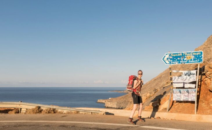
This coastal walk follows the south coast from the car-free village of Loutro to Sweetwater Beach (Glyka Nera), where freshwater springs bubble up through the sand at the shoreline. Combine the hike with the ferry from Hora Sfakion to Loutro for a no-car-needed half-day adventure along the E4 European path.
12. Mountain Hike: Psiloritis Summit (Mount Ida)
Psiloritis Summit – Quick Facts
- Distance: About 7 kilometers (4.35 miles) ascent from the Nida Plateau
- Difficulty: Hard
- Hiking time: 8–10 hours round-trip
- Season: June to September only
- Trailhead: Nida Plateau
The summit of Mount Ida, at 2,456 m Crete’s highest point, tests experienced hikers with a 7 kilometers (4.35 miles) ascent from the Nida Plateau and an 8 to 10-hour round trip. Start before dawn, and attempt the climb only between June and September. Few visitors complete this genuine mountain hike.
Hiking in Crete FAQs
Is Crete good for hiking?
Yes, Crete ranks among Greece’s top hiking destinations. The island has more than 50 marked trails ranging from 45-minute family walks (Zakros, Patsos) to multi-day routes on the E4 European long-distance path. It combines limestone gorges, coastal cliffs, palm forests, and 2,000 m summits on a single island, with the best months falling in April to June and September to October.
How difficult is the Samaria Gorge?
Samaria Gorge rates Moderate to Hard. The challenge sits in the first 6 kilometers (3.73 miles), which drop 800 m down a steep switchback, hard on the knees. After that, the trail flattens onto the gorge floor for 11 kilometers (6.84 miles) of rocky riverbed walking. Total: 17.5 kilometers (10.87 miles), 1,230 m of descent, 5 to 7 hours. Reasonably fit adults complete it comfortably; children 8 and up with hiking experience manage it, while children under 5 should not attempt it.
What is the best time of year to hike in Crete?
The best months are April to June and September to October. April to June brings peak wildflowers and 22 to 26°C temperatures; September to October offers cooler weather, fewer crowds, and a sea still warm enough for the post-hike swim. Avoid July and August for long gorges, since Samaria becomes dangerously crowded and the heat reaches 35°C+. November to March is wet season, and most high-altitude gorges close.
Can you hike Samaria Gorge with kids?
Yes, for children aged 8 and up with prior hiking experience. Samaria runs long but stays non-technical, with no climbing, ladders, or exposure, just a long descent and a long riverbed walk. Bring a child-sized hiking pole for the steep first section. For children under 8, choose Imbros Gorge (gentler, half the length) or Zakros Gorge (45 minutes, almost flat) instead.
Do I need a car to hike in Crete?
A car works as the most flexible option for reaching Crete’s trailheads, since most sit 30 to 90 minutes from the main towns by mountain road, and many gorges run point-to-point, ending somewhere different from where you started. One-way car hire lets you pick up in Chania and drop off in Heraklion. Public buses reach Samaria (daily KTEL service from Chania) and Imbros, but coverage to smaller gorges (Patsos, Richtis, Agia Irini) stays minimal or nonexistent.

Are there coastal hikes in Crete, or only gorges?
Yes, Crete offers coastal hikes as well as gorges, most of them along the south coast. The Loutro–Sweetwater Beach trail, the Loutro–Agia Roumeli stretch of the E4 path, and the walks linking the south-coast villages of Sfakia all run car-free and ferry-accessible as day hikes. The Aradena Gorge–Marmara–Loutro combination makes one of the best multi-format days on the island.
Plan Your Crete Hiking Trip – Quick-Pick Guide
Use this guide’s trail specs to plan your routes before you arrive. Your quick-pick by hiker profile:
- First-timer / half-day: Imbros Gorge, easier than Samaria, dramatic scenery, year-round access.
- Serious hiker / full day: Samaria Gorge, Europe’s longest, the Iron Gates, ferry-return logistics.
- Family with young kids: Zakros Gorge, 45 minutes, gentle, with a Minoan palace at the end.
- Off-the-beaten-path: Agia Irini Gorge, quiet, finishes at a Libyan Sea beach with tavernas.
- Short morning hike: Patsos (Agios Antonios), 2 kilometers (1.24 miles), shaded, with a cave church en route.
- Hidden gem: Richtis, an easy 1.5 hours, ending at a 20-metre waterfall and swimming pool.
- Advanced / technical: Aradena Gorge, iron ladders, a vertical descent, finishing at Marmara Beach.
Hiking in Crete puts you inside landscapes most visitors only photograph from afar: limestone canyons, palm oases, and Bronze Age burial caves. Rental Center Crete offers one-way car hire from every major airport and port in Crete for travellers who need transport between trailheads.