Analipsi Crete: All You Need to Know by Rental Center Crete Experts
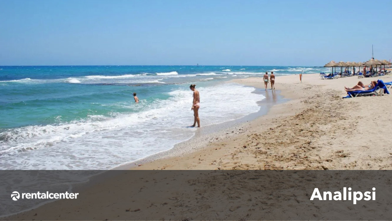
Analipsi is a village on the northern coast of Crete, 21 kilometres (13,05 miles) east of Heraklion, the capital city. It lies in a valley with olive groves near the popular tourist area stretching from Kato Gouves to Anissaras. The history of Analipsi dates back to the period of Ottoman rule in Crete in the 1800s when a small settlement called "Svourou" or "Svourou Metohi" existed in the area. Shepherds from the Lasithi Plateau region started moving to this warmer area during the winter months to feed their animals, and they began building basic stone houses, forming the village. A church dedicated to the Ascension of Christ was established in 1896, giving the village its current name, "Analipsi" (meaning Ascension in Greek).
Psaromoura Beach: All You Need to Know by Locals
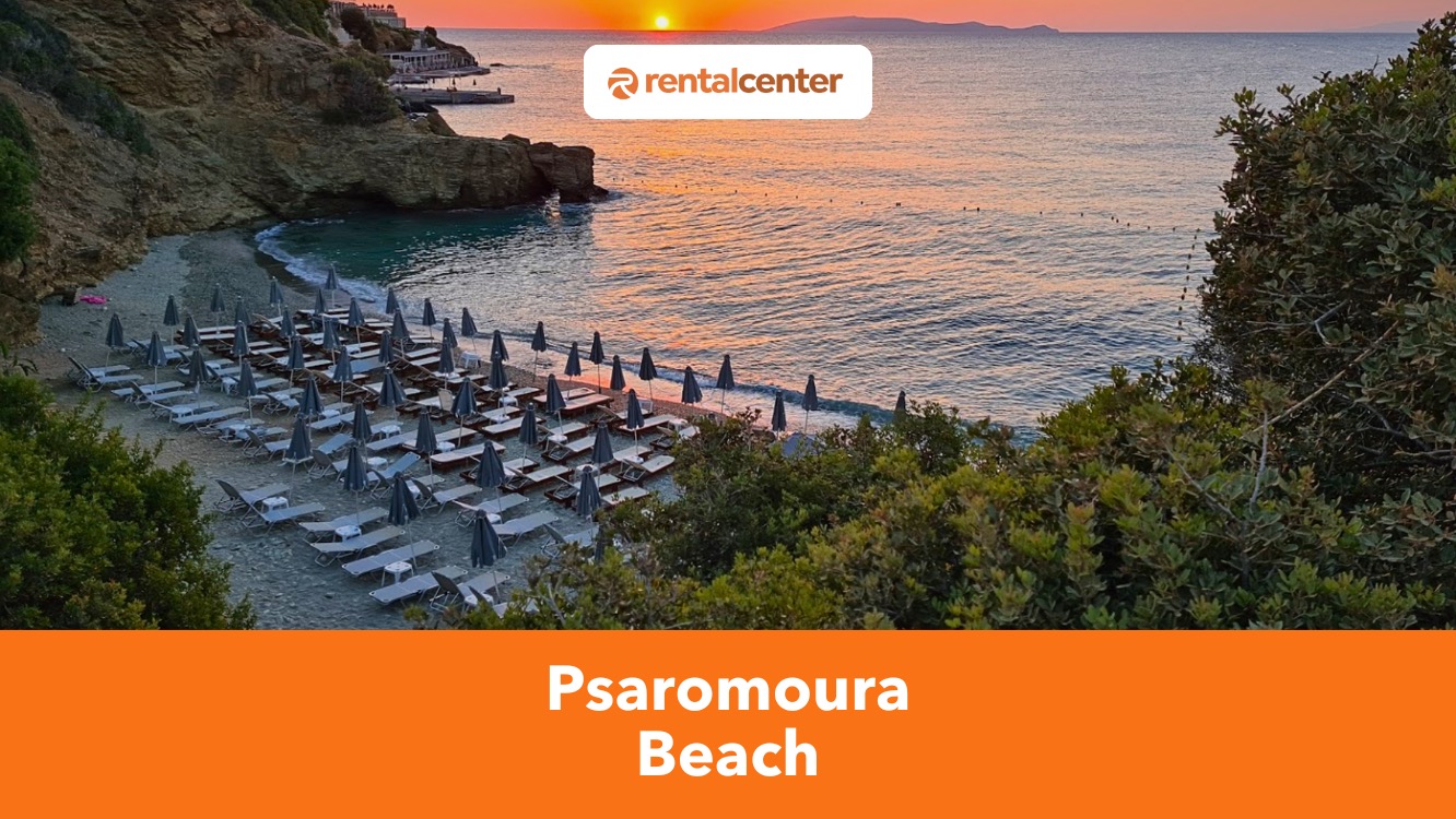
Psaromoura Beach is a small, pebbled cove in northern Crete, offering a naturally enclosed setting with calm waters ideal for swimming and snorkeling. It is located within a rocky bay, shielding it from strong winds and creating a peaceful coastal retreat with clear, inviting waters. Psaromoura Beach attracts visitors seeking a quieter alternative to larger beaches, combining scenic surroundings with a more intimate seaside experience.Psaromoura Beach is located 22 kilometers (14 miles) northwest of Heraklion, near the seaside village of Agia Pelagia. The beach can be reached via a 25-minute drive from Heraklion, following the E75 highway toward Rethymno before taking the exit for Agia Pelagia.
International Driving License: Do you need it to Rent a Car in Greece?

Travelers planning to drive in Crete must understand Greece’s license requirements. An International Driving Permit (IDP) is mandatory for drivers from non-EU or non-EEA countries such as the United States, Canada, and Australia. This document must accompany a valid domestic license and serves as its official translation.Rental Center Crete accepts licenses written in the Latin alphabet without an IDP, but most agencies in Greece require one. Visitors can apply for an IDP through authorized agencies in their home countries, such as AAA in the United States, the Post Office in the UK, and the CAA in Canada.
What is the Average Cost of Renting a Car in Greece?

The average cost of renting a car in Greece varies according to the vehicle type, rental term, season, and agency. Daily rates typically range between 18 € ($19.44, £15.47) and 49 € ($52.88, £42.10), with economy and compact cars offering the lowest prices. Longer rentals can lower daily costs to as little as 8 € ($8.64, £6.88) per day, especially during the off-season. March is the most cost-effective month, with the lowest rates across all vehicle categories. Some rental companies include hidden costs, but Rental Center Crete includes everything in the advertised price. This guide gives guests a comprehensive picture of how to budget for car rental throughout their stay in Greece.
Seitan Limania Beach: A Hidden Gem on Crete’s Rugged Coast

Seitan Limania Beach is one of Crete’s most visually dramatic and remote coastal spots, nestled in a narrow cove on the Akrotiri Peninsula, just 22.2 kilometers (14.1 miles) northeast of Chania, Seitan Limania, also called Agiou Stefanou beach, is a secluded beach that is accessible via a challenging downhill trail, and features a compact shoreline of coarse sand and pebbles surrounded by steep limestone cliffs and clear turquoise waters.
Kastri Beach: All You Need To Know By Locals
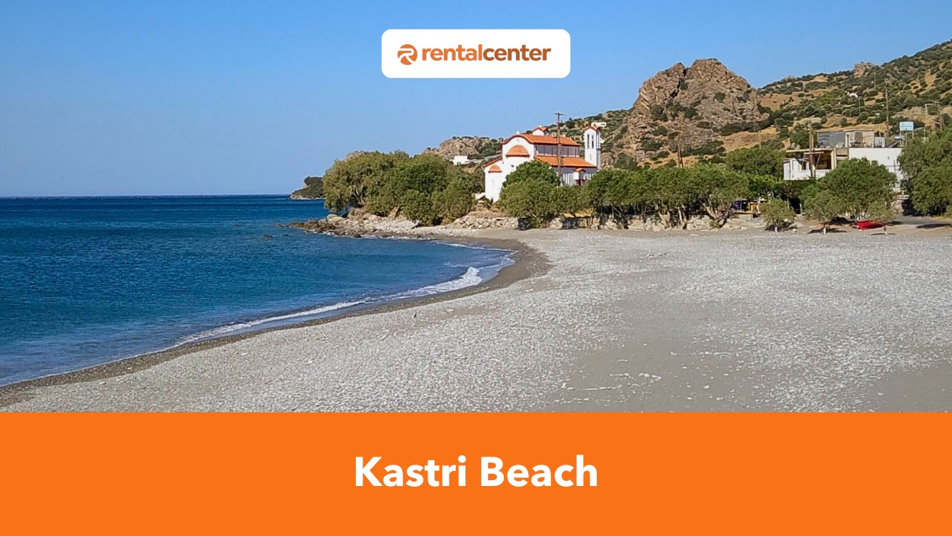
Kastri Beach is a pebbly shore on Crete’s southern coast, located 60 kilometers (37.2 miles) from Heraklion. The beach is named after the nearby village of Kastri and is known for its glistening waters and relaxed atmosphere. Kastri Beach has loungers and umbrellas in some portions of its shoreline, while much of it remains unspoiled, allowing visitors to admire Crete’s natural beauty.
Almyros Beach: All You Need To Know By Locals
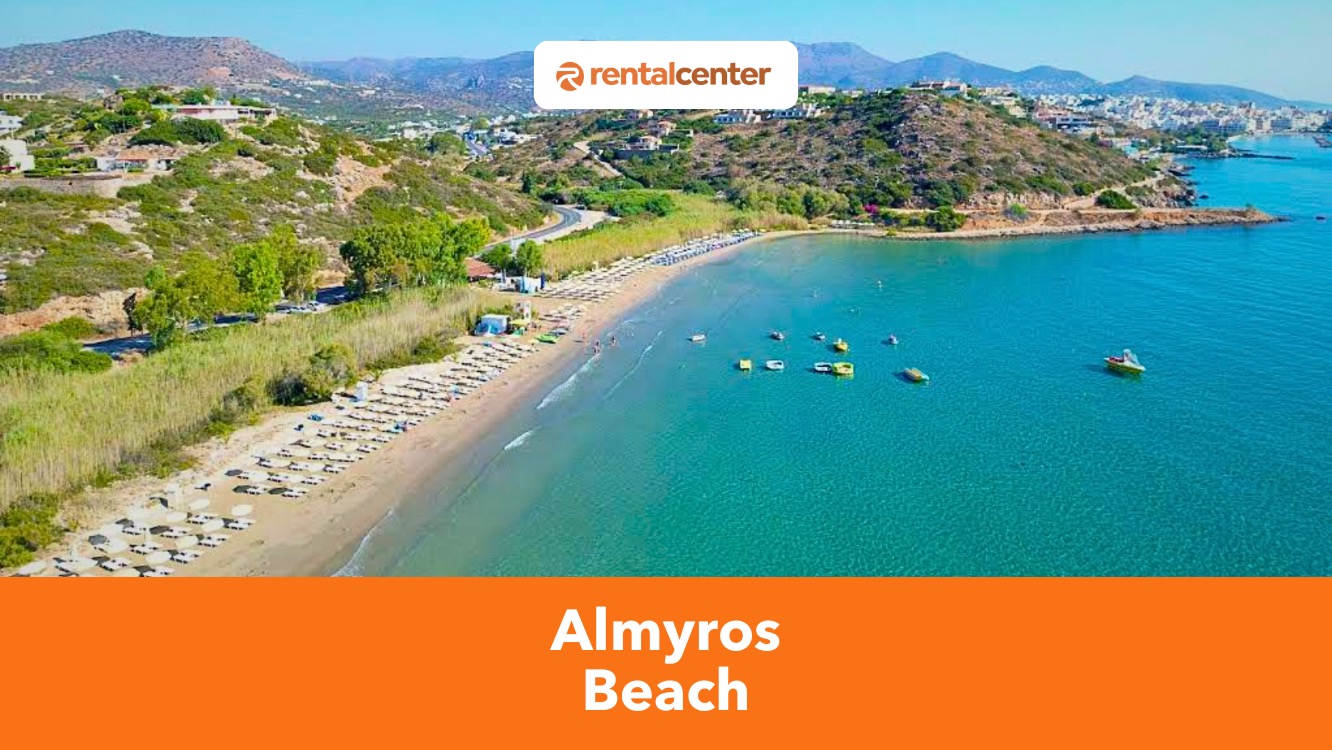
Almyros Beach is located 2.5 km (1.5 mi.) from Agios Nikolaos in northeastern Crete. The beach is named after the Almyros River which flows directly into the sea, creating a mix of fresh and saltwater. The beach is ideal for families and nature enthusiasts with its shallow, clear waters and lush greenery. Facilities include sunbeds, umbrellas, and a beachside café.
Tris Ekklisies Beach: All You Need To Know By Locals
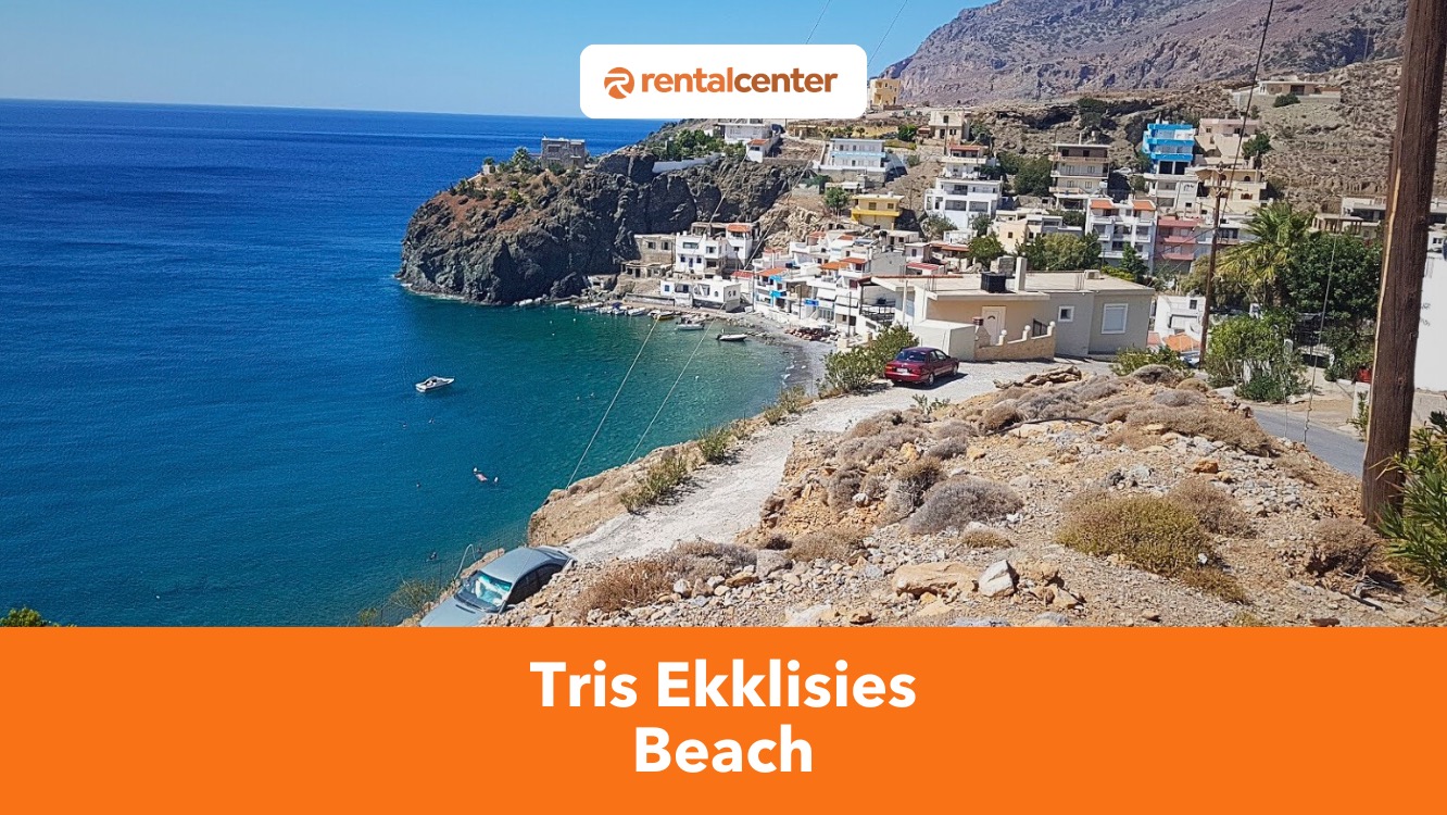
Tris Ekklisies Beach is a coastal attraction located 64 kilometers (39,76 miles) south of Heraklion in Crete. Tris Ekklisies is named after the three nearby churches and features fine golden sand, clear waters, and rugged cliffs. It's a peaceful escape from Crete’s more touristy spots, perfect for visitors seeking relaxation. The beach can be accessed by car, offering scenic views along the Asterousia Mountains, and is equipped with sun beds, umbrellas, and nearby tavernas.
Psari Forada Beach (Sidonia): All You Need To Know By Locals
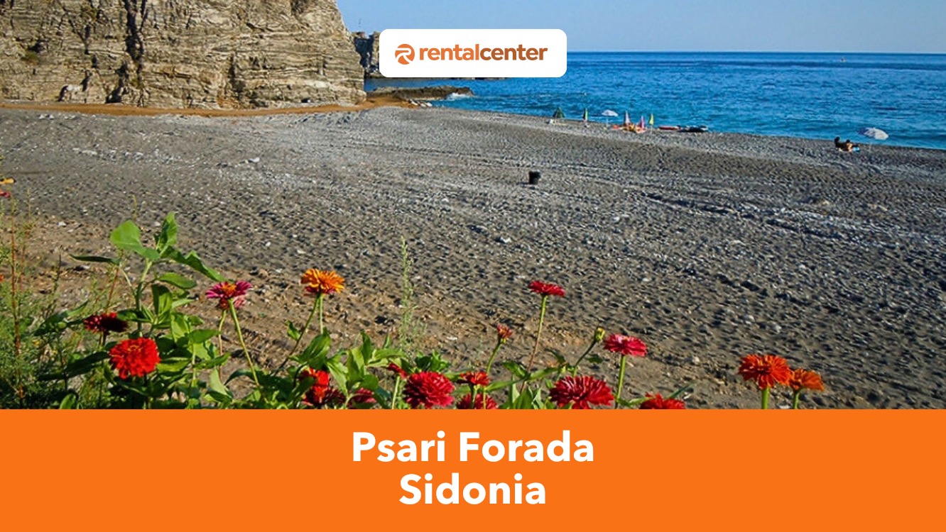
Psari Forada Beach is a coastal retreat in the fishing village of Sidonia in Crete, situated 74.8 km (46.5 miles) south of Heraklion. The beach features dark-colored sand and deep blue waters, providing a peaceful alternative to busier Crete beaches. Psari Forada is easily reachable via KTEL buses or cars and is ideal for swimming, snorkeling, and sunbathing.
Kali Limenes Beach: All You Need to Know by Rental Center Crete Experts
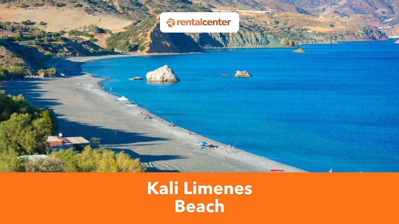
Kali Limenes Beach, known as Good Ports Beach or Kaloi Limenes, is a secluded coastal destination on Crete’s southern coast. Kali Limenes Beach lies 75 kilometers (46.6 miles) southwest of Heraklion, within the Asterousia Mountains, offering clear blue waters, a mix of fine sand and pebbles, and sheltered coves. The beach benefits from a natural wind barrier, ensuring calm swimming conditions for most of the year.
Koutsouras Beach: All You Need to Know by Rental Center Crete Experts
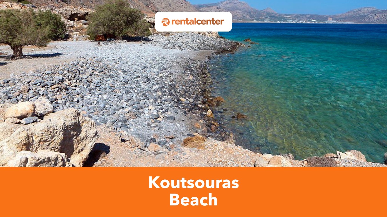
Koutsouras Beach is a coastal destination on the southern coast of Crete, west of the village of Koutsouras. It features dark grey pebbles, clear blue waters, and natural shade from tamarisk trees. Koutsouras Beach is sheltered from strong northern winds, ensuring calm waters throughout the year and making it an ideal spot for swimming. The beach holds a Blue Flag certification, ensuring high environmental standards, cleanliness, and safety.
Agios Charalambos Beach: A small, white sand beach in Crete!
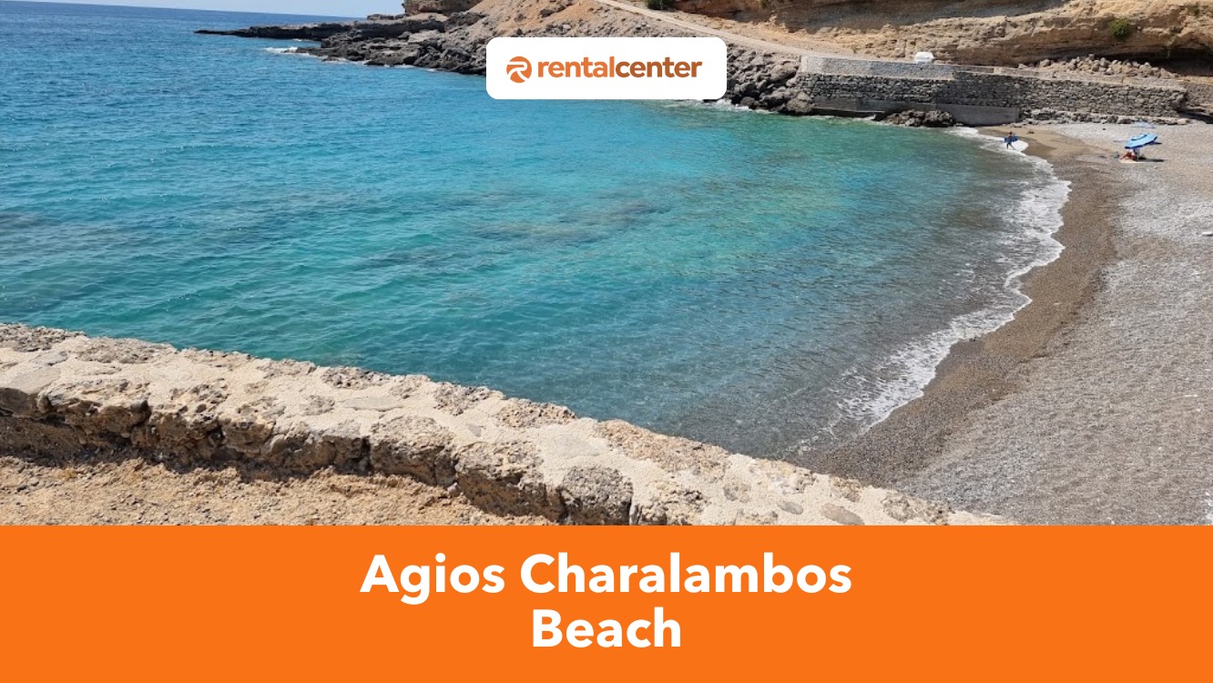
Agios Charalambos Beach is a small, secluded beach 60 kilometers (37.3 miles) south of Chania and 1.5 kilometers (0.9 miles) east of Chora Sfakion, offering a peaceful retreat with clear blue waters and a natural landscape. It features a mixed seabed of fine pebbles and sand, with sunbeds, umbrellas, and a beachside taverna providing a comfortable seaside experience.
Tertsa Beach: All You Need To Know By Rental Center Crete
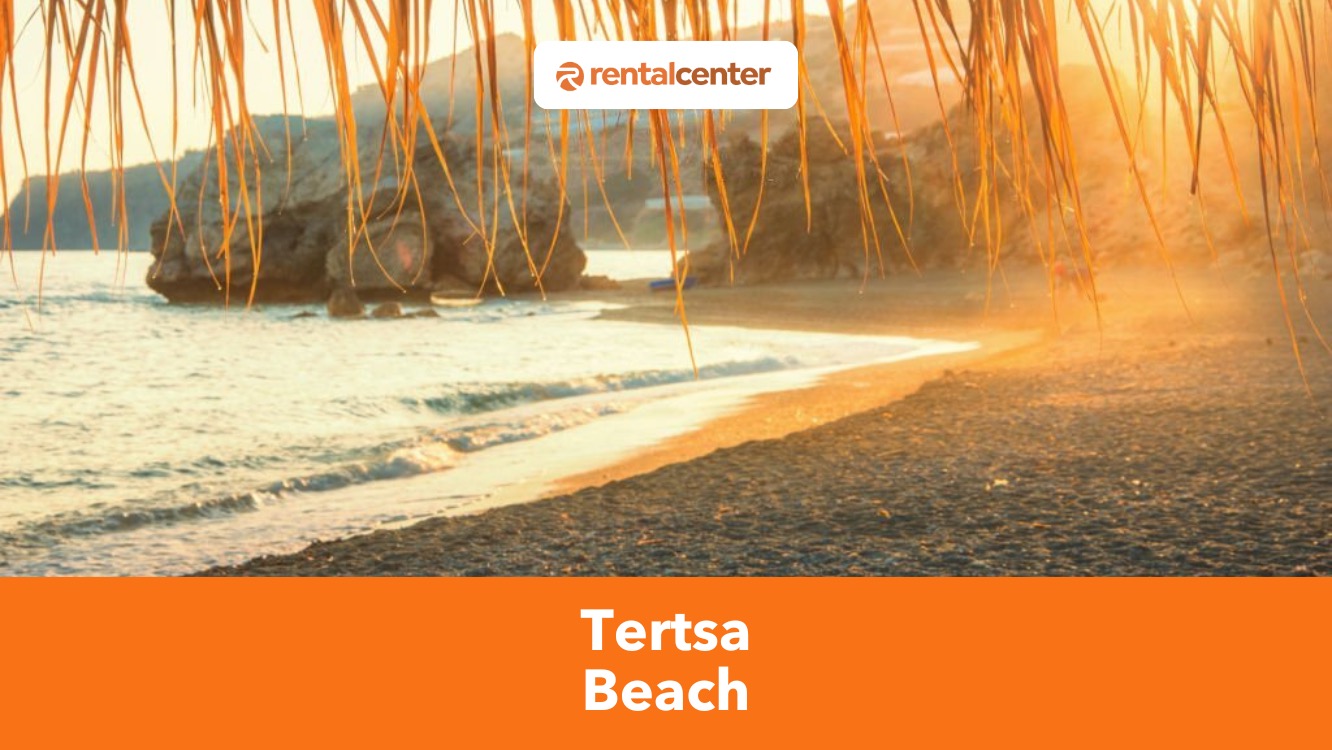
Tertsa Beach is a coastal retreat 79 kilometers (49 miles) south of Heraklion in Crete. Tertsa is a tourist destination with coarse sands, turquoise waters, and fine pebbles, offering a quiet escape from the region’s more crowded attractions. The surrounding cliffs and hills enhance its untouched beauty, while a few sun loungers and traditional tavernas provide convenience without disrupting the beach’s natural charm.
Samaria Gorge: Hiking, Open Hours, Map, Attractions and Car Rental Guide
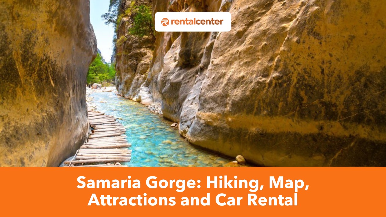
Samaria Gorge is one of Crete’s most iconic natural wonders, drawing hikers globally to experience its rugged beauty, rich history, and ecological significance. The gorge stretches 16 kilometers (9.9 miles) through the White Mountains in southwest Crete, and descends from the Omalos Plateau to the Libyan Sea at Agia Roumeli.
Mochlos Beach: A Beach in a small fishing village in Eastern Crete!
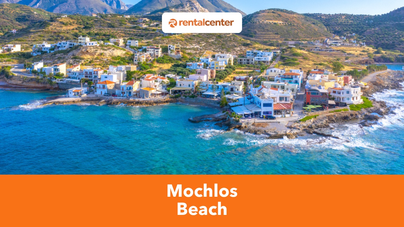
Mochlos Beach is a small, unspoiled beach on the northeastern coast of Crete, located 37 kilometers (23 miles) east of Agios Nikolaos and 35 kilometers (22 miles) west of Sitia. The beach remains naturally sheltered by rocky formations, keeping its waters calm and clear throughout most of the year.
Stavros Beach: All You Need To Know By Locals
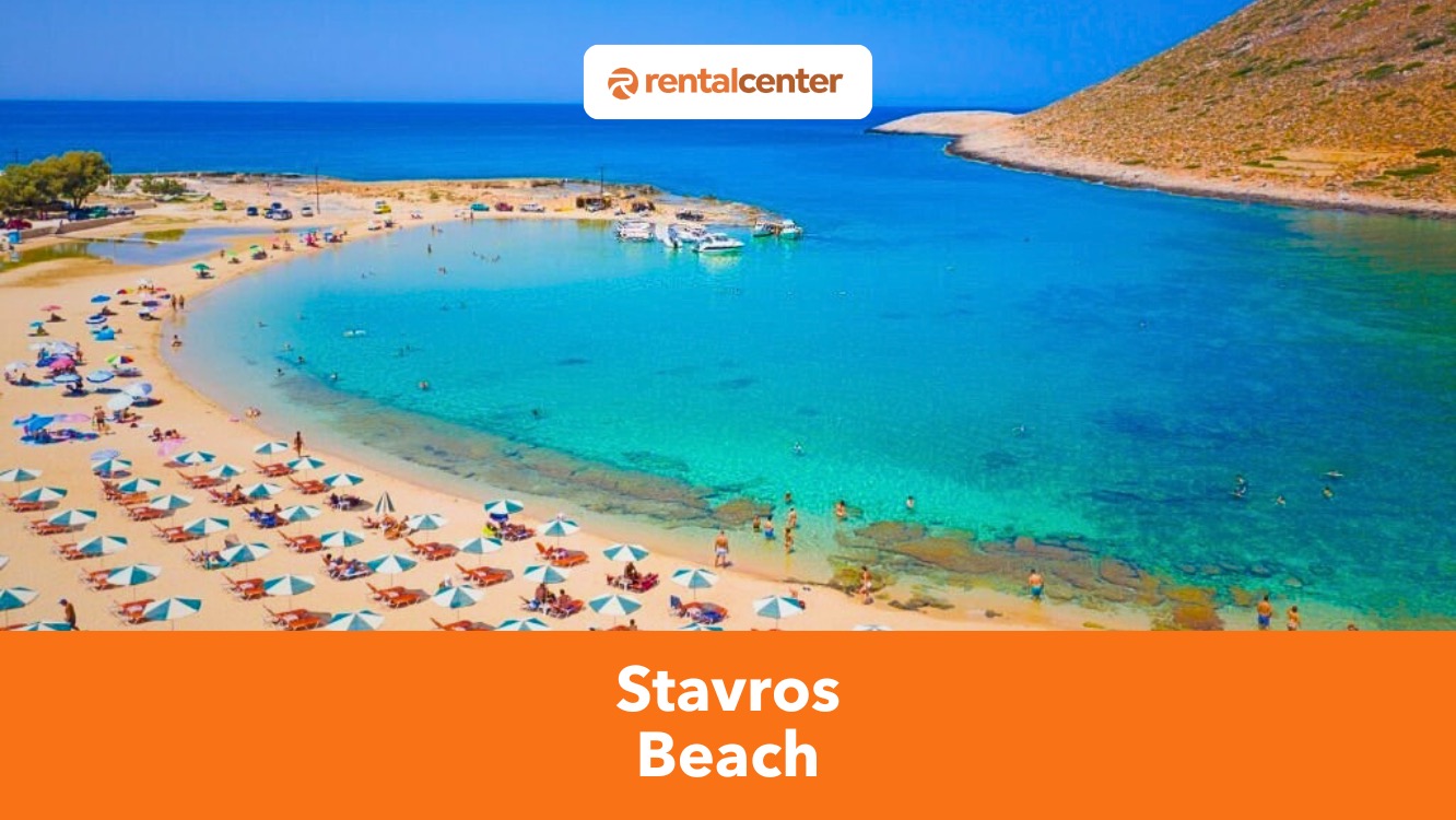
Stavros Beach is an amazing beach located 15.4 kilometers (9.5 miles) northeast of Chania on the Akrotiri Peninsula in Crete. The beach acquired international recognition for appearing in the 1964 film Zorba the Greek. Stavros’ distinctive features include its powdery sands, clear waters, and a natural lagoon protected by a limestone mountain, which makes it an excellent spot for families and travelers seeking relaxation. Visitors can enjoy sun loungers, umbrellas, and nearby tavernas serving Cretan cuisine.
Tympaki Beach: All You Need To Know By Locals
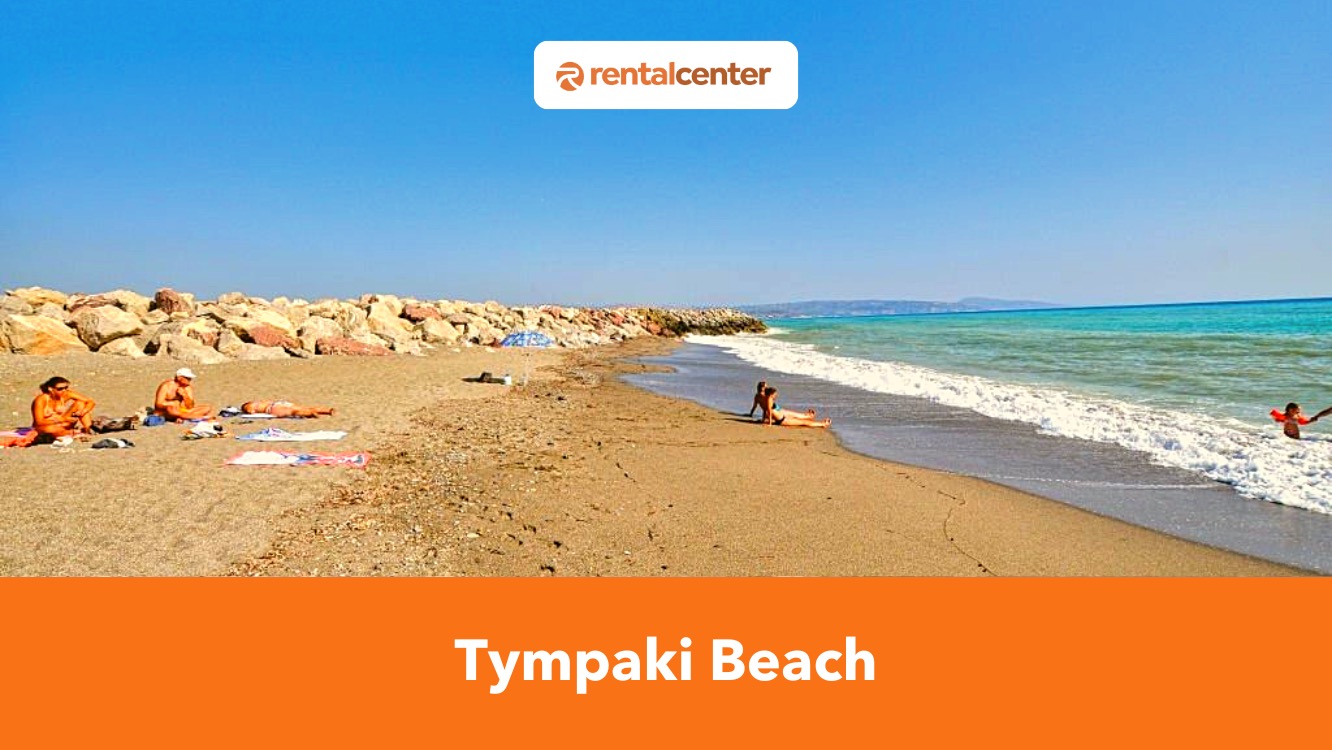
Tympaki Beach is a beach in Crete’s southern coast, located 62.3 km (38.7 miles) southwest of Heraklion. Tympaki has dark volcanic sand, clear waters, and strong winds, beckoning windsurfers but is less suitable for tourists seeking calm swimming conditions. Tympaki Beach lacks organized facilities, with no sunbeds or parasols, and only a few tavernas in the area. Accommodations are not available directly on the beach, but the nearby town of Tympaki offers guesthouses and holiday rentals.
Fascinating Facts about Crete: Basic, Historical and Cultural Information
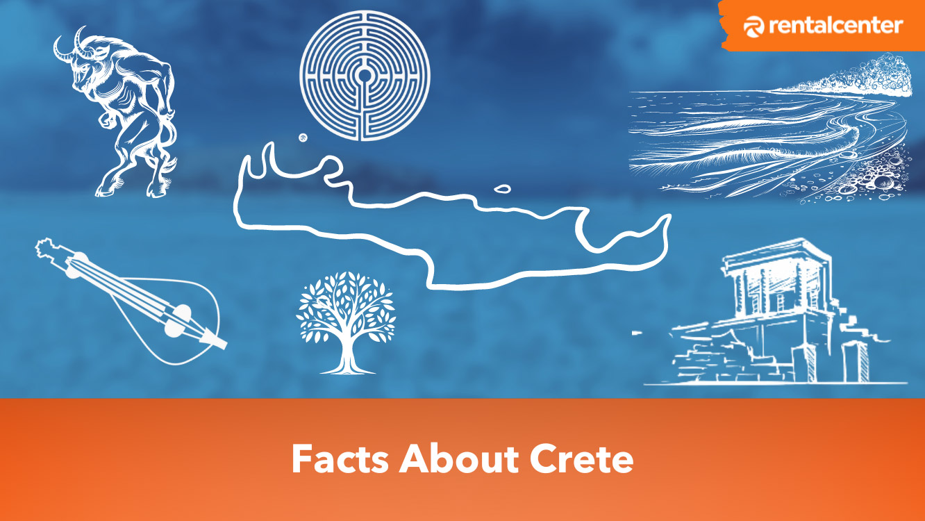
If you're a traveler by soul and Crete is one of the many countries on your bucket list, then you're in for a huge treat. The island is among the best places to visit in the world, and you're certainly going to love it. So whether you're a solo traveler, a couple on your honeymoon, or with your family, Crete is a place you should all visit.
Is Crete Expensive? A Guide to Prices in Crete in 2025

For many years, the idea of a Crete holiday was only on the radar for those seeking a trip to an all-inclusive resort. Its ideal southern Greece location means great weather and over 2000 hours of sunshine every year. Travellers were ready to pay a lot to enjoy the Crete's atmosphere without having to sacrifice any of the comforts of home. It was not easy to visit Crete on a budget and has many people asking the question: Is Crete expensive?
Kaminaki Beach: All You Need to Know by Locals
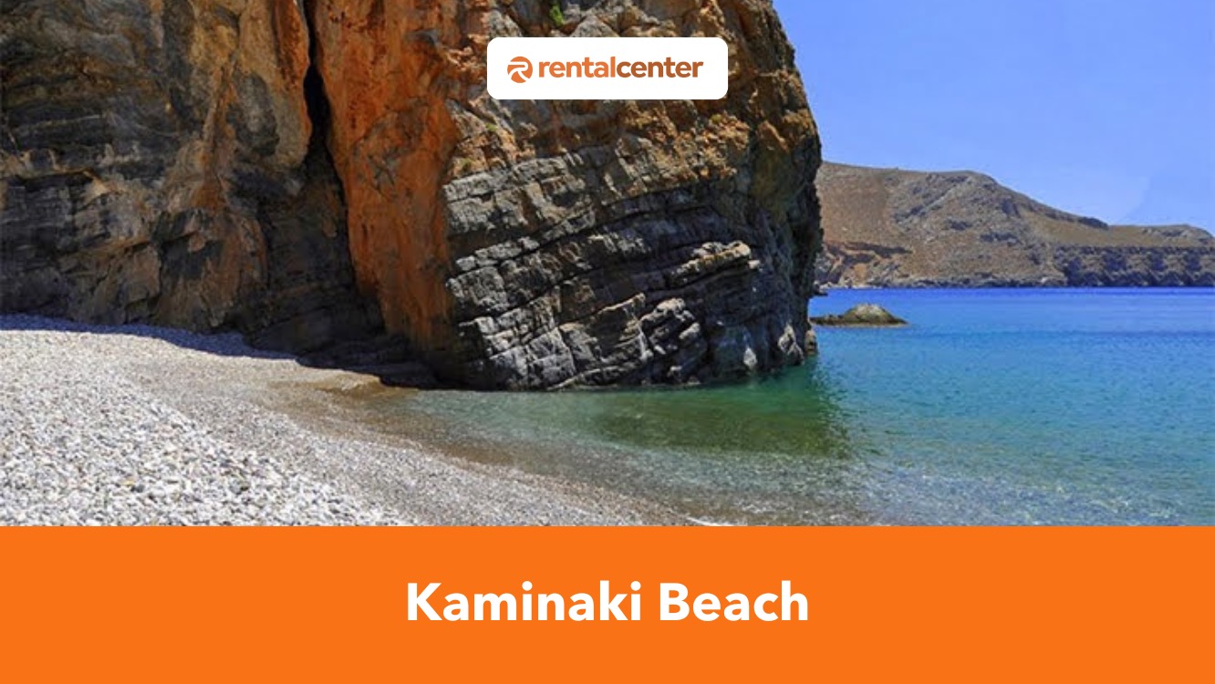
Kaminaki Beach is a small, secluded pebbled beach in southern Crete, located 58 kilometers (36 miles) south of Heraklion, in the southeastern slopes of the Asterousia Mountains. The beach remains naturally sheltered by steep cliffs and rugged terrain, protecting it from strong winds while preserving its untouched landscape.